Awesome 3-night JMT & PCT backpacking trip in Ansel Adams
This 3-night hike in Ansel Adams covers some of the highlights along the JMT, like Thousand Island and Garnet lakes, with some off-trail adventure added in.
My previous backpacking trip to Desolation Wilderness had been a nice and leisurely weekend stroll. This time around, I wanted something more physically demanding and adventurous. I wanted to go higher, farther, and off-trail. Ideally, I wanted to go to Ansel Adams wilderness to revisit some of my favorite places along the JMT.
I was window shopping permits on recreation.gov when I spotted a single permit for the Rush Creek trailhead to the Ansel Adams Wilderness in Inyo National Forest. Starting from there, I could re-visit some of my favorite places along the JMT and explore new areas in the high country.
I booked the permit and started planning.
The route through Ansel Adams Wilderness
Start at Rush Creek Trailhead
Day 1: Agnew Lake, Gem Lake, Waugh Lake, JMT/PCT over Island Pass to Thousand Island Lake. 13.2 miles. 3,800 ft elevation gain.
Day 2: PCT/JMT past Emerald Lake, Ruby Lake, Garnet Lake. Up Shadow Creek to Ediza Lake. Off-trail past Iceberg Lake and Cecile Lake to Minaret Lake. 11.5 miles. 2,400 ft elevation gain.
Day 3: Minaret Trail along Minaret Creek down to Devil’s Postpile. Back North on the PCT past Agnew Meadows. High Trail up past Summit Lake to Clark Lakes. Back down to Gem Lake. 23.2 miles. 3,500 ft elevation gain.
Day 4: Rush Creek trail back down past Agnew Lake to the Rush Creek Trailhead. 4.9 miles. 800 ft elevation gain.
Day 1: From zero to 10,000 ft in a thunderstorm
I started driving after 5. Getting to the trailhead from the Bay Area means crossing the Sierra to get to the east side. With Yosemite’s COVID-19 restrictions in place, I would have needed to secure a day permit to cross on 120 over Tioga Pass. Instead, I opted to go north, over Sonora Pass, on 108.
I arrived at the trailhead after 10. It was a beautiful day: clear blue skies and a light breeze. I pulled into the last parking spot, slapped on some SPF 70, and started the long climb to Thousand Island Lake.
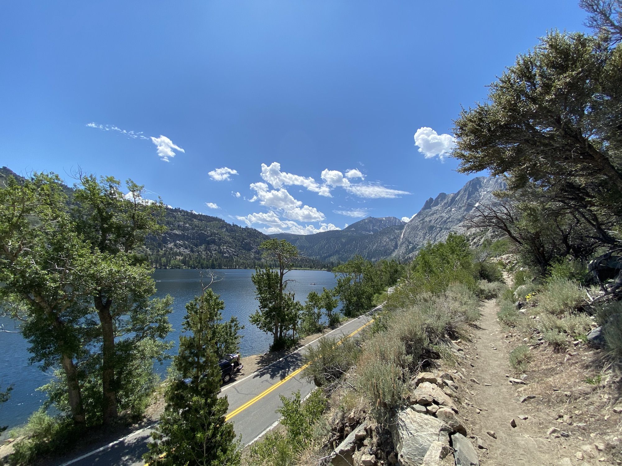
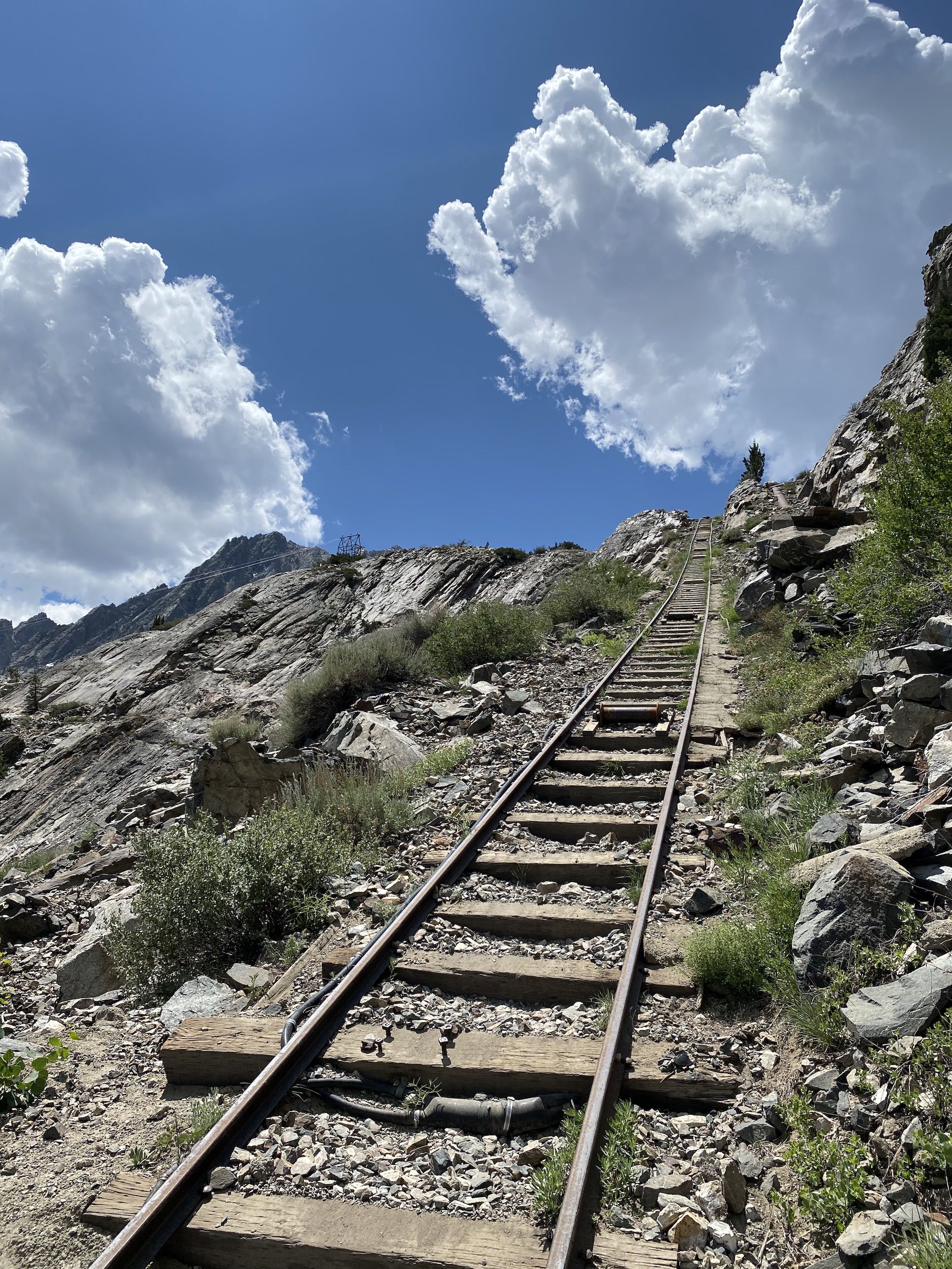
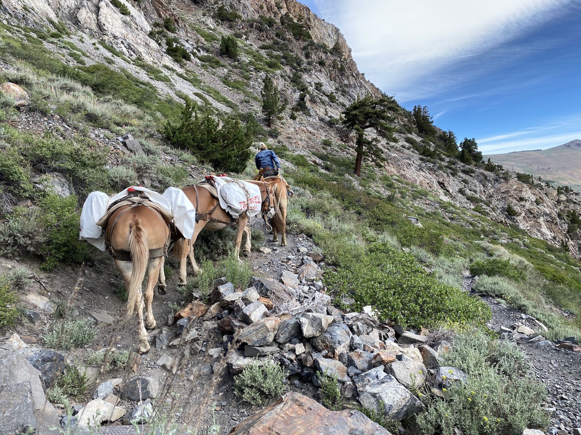
Like most trails in the area, the Rush Creek trail is graded for horse use, which means it’s not that steep. But it was exposed. There was no tree cover on most of the ascent before Gem Lake.
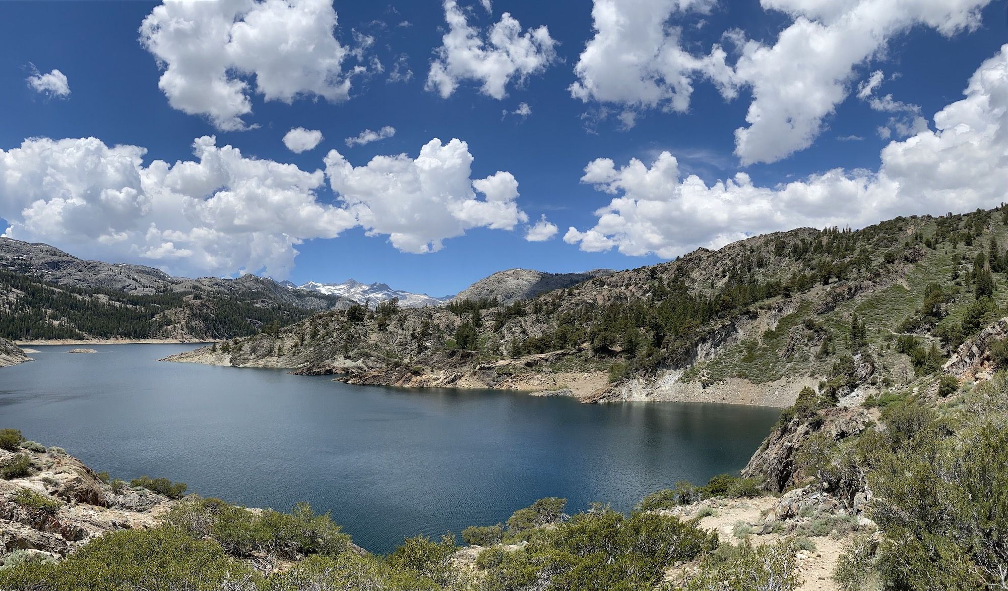
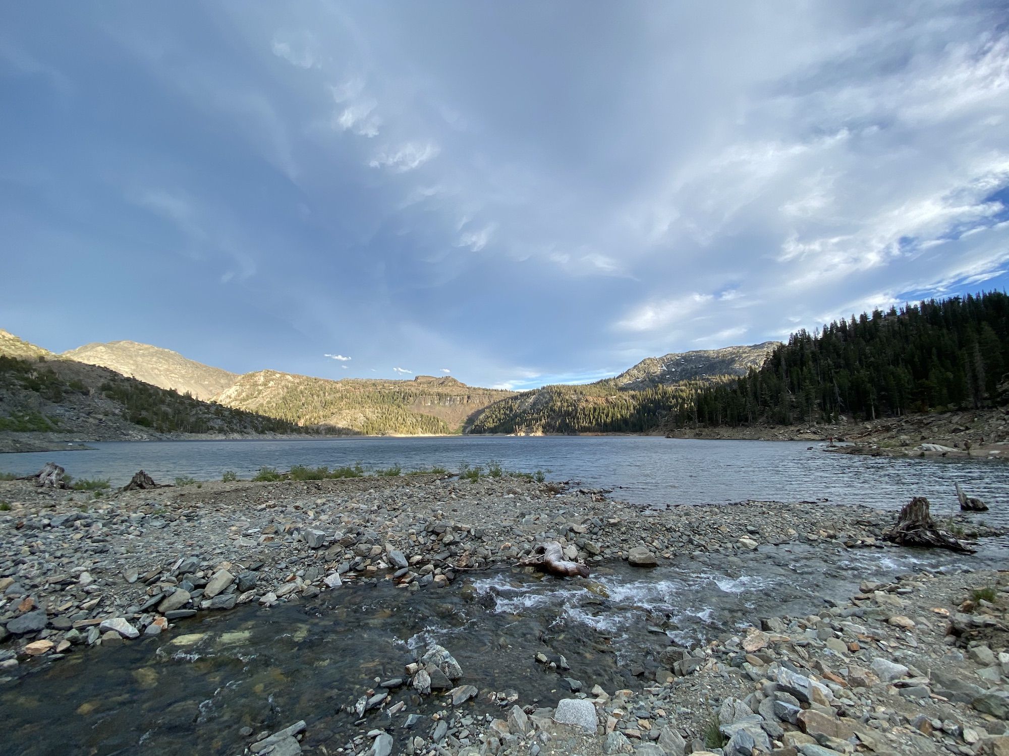
All three big lakes along the trail are reservoirs with big dams at their outlets. There had been very little snow the previous winter, so the reservoirs were already half-empty even though it was still early summer.
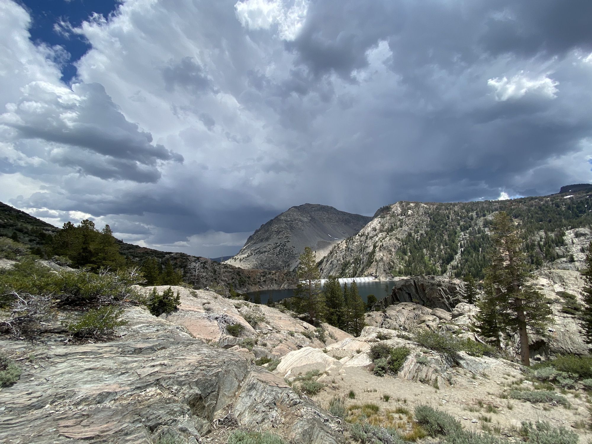
As I crested the trail to Gem Lake, I could see dark clouds forming behind me to the east. I stopped for lunch at a small stream running into Gem Lake, the first water source since the trailhead that didn’t require climbing down 100 ft to the lake. The clouds grew more ominous as I ate. I opted to skip my coffee and keep pushing on, in hopes of getting over Island Pass before the storm rolled in.
The rain and rumble started moments after I had packed up my lunch. At first, it was a gentle summer rain. I kept hiking.
The trail snaked through a sparse forest, occasionally crossing exposed rocks. The raindrops kept growing bigger. The thunder echoed off the surrounding mountains in an impressive boom.
I walked fast and I could feel it in my lungs. My trip had started from sea level less than 8 hours earlier and was now trying to hurry up a steep trail at 9,500 ft while lugging my gear. I was thankful I had been training for a half-marathon, all extra oxygen-carrying capacity was needed.
At Waugh Lake, the downpour was joined by hail. The thunder got closer. I decided it was time to take a break and wait for the worst of the weather to pass before continuing. I found a sheltered place under a thicket of fir trees and laid out my pad.
I sat there listening to an audiobook, looking at the ground, getting covered in ice. 20 minutes later, the rain allowed me to continue.
Shortly after crossing Rush Creek, I joined the JMT south. The rain had decreased to a soft pattering. I ran into several groups of hikers hunkered under trees just before Island Pass. We chatted briefly, but I kept going to make sure I got over the pass before the next wave of thunder hit.
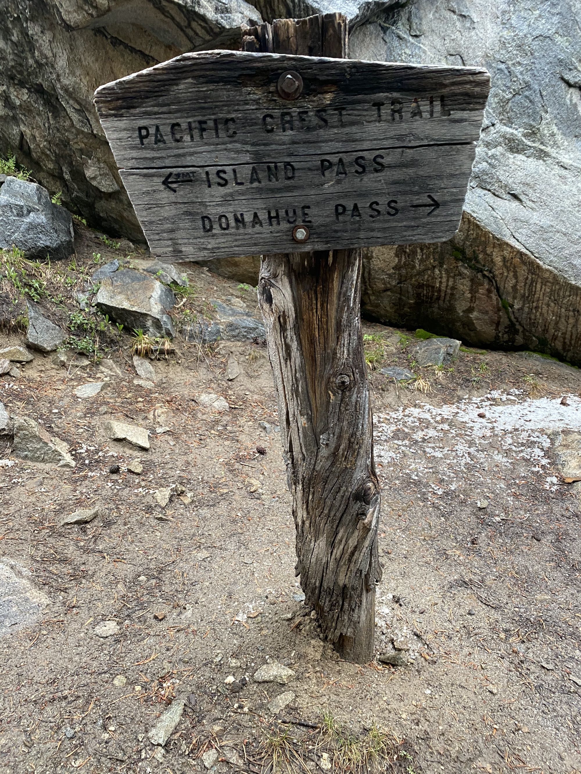
Thankfully, Island Pass isn’t as exposed as most other passes of the JMT. Even so, I had no intention of staying up there any longer than needed.
It kept drizzling as I hiked over the pass. The dark clouds rolling in over the mountains were foreboding of heavy rain.
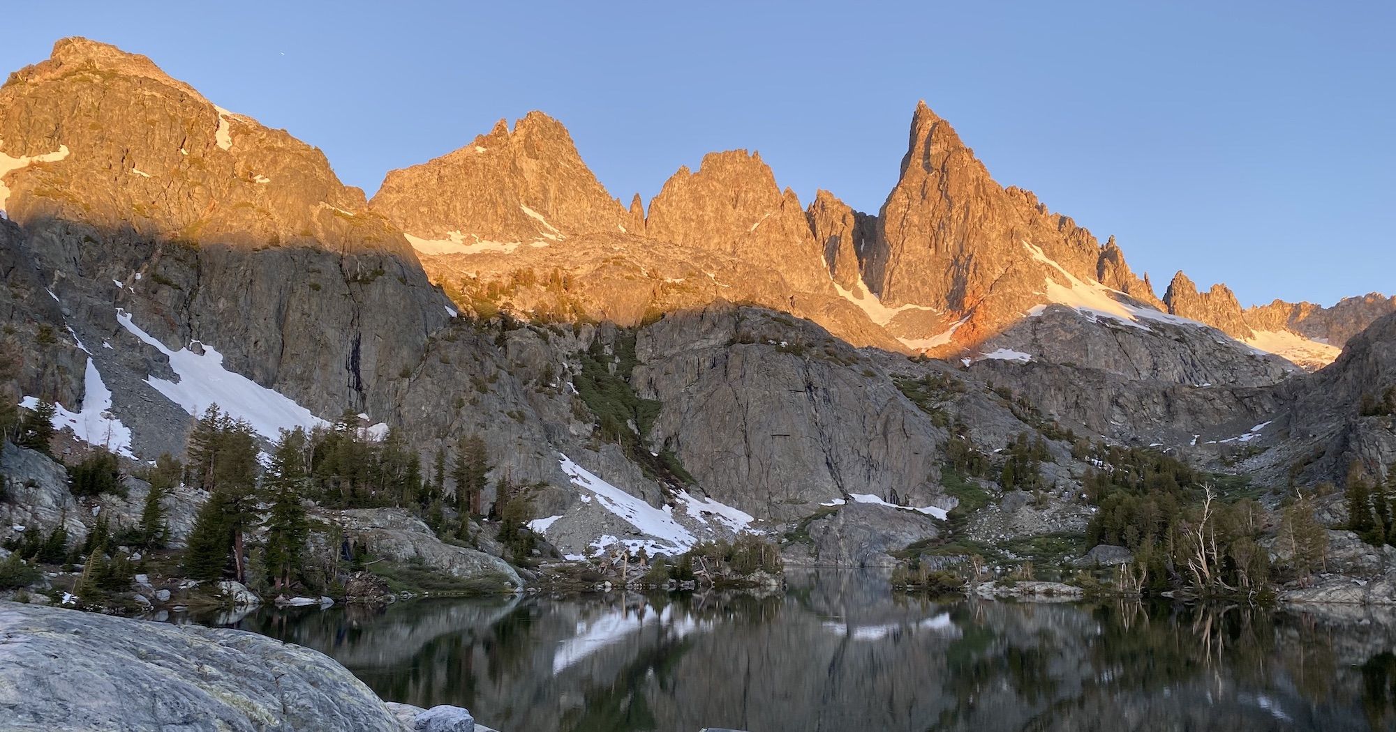
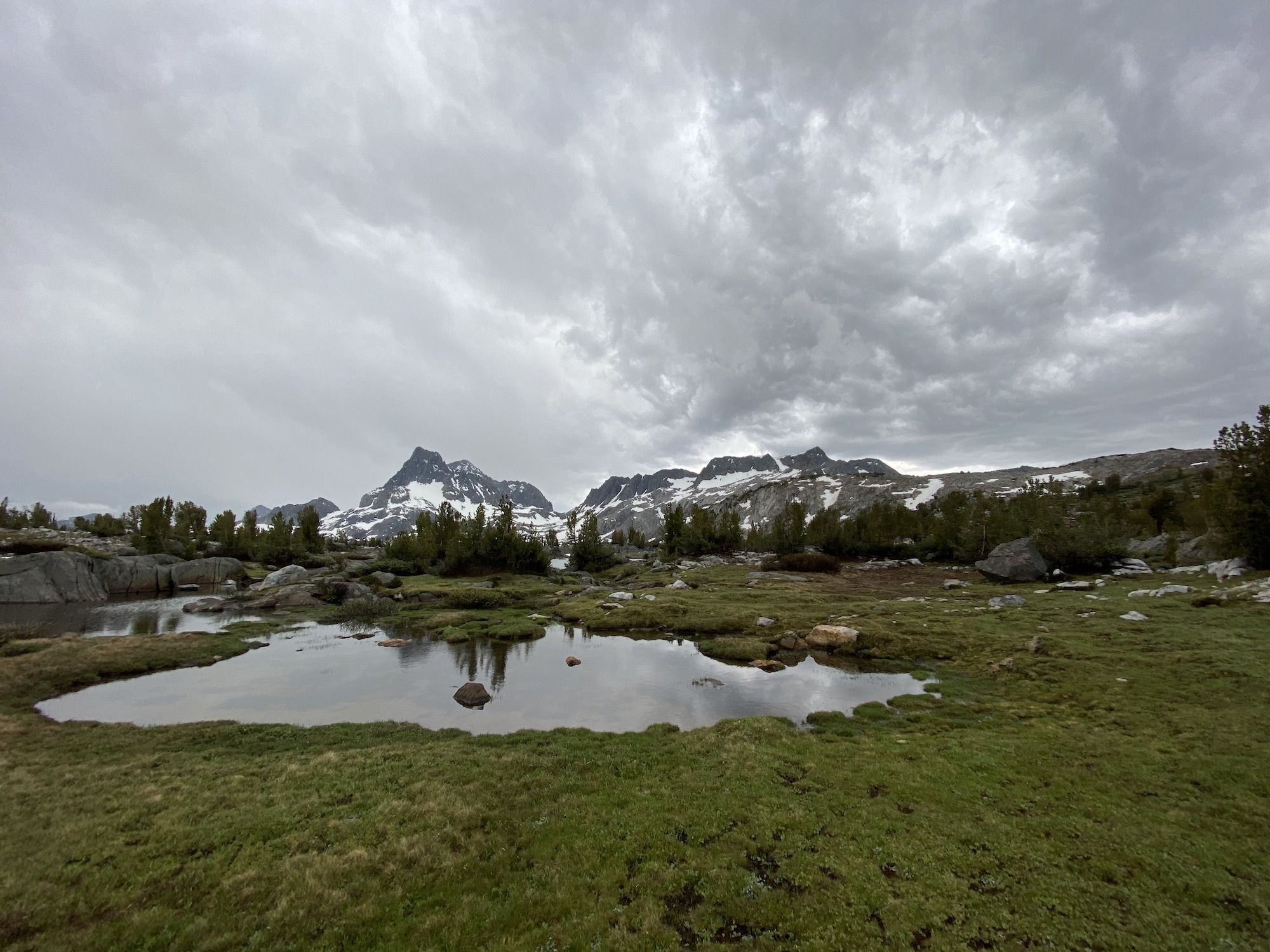
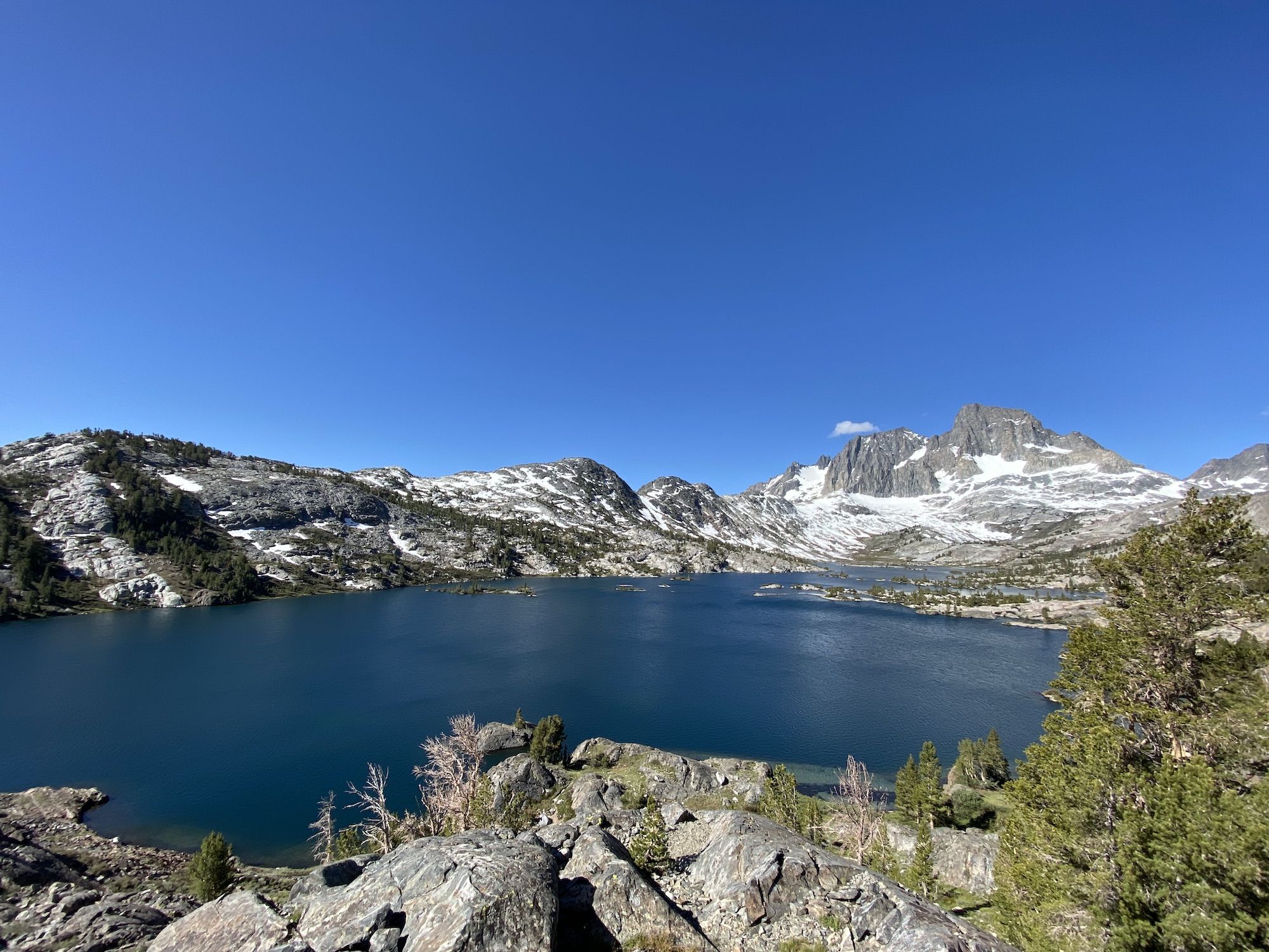
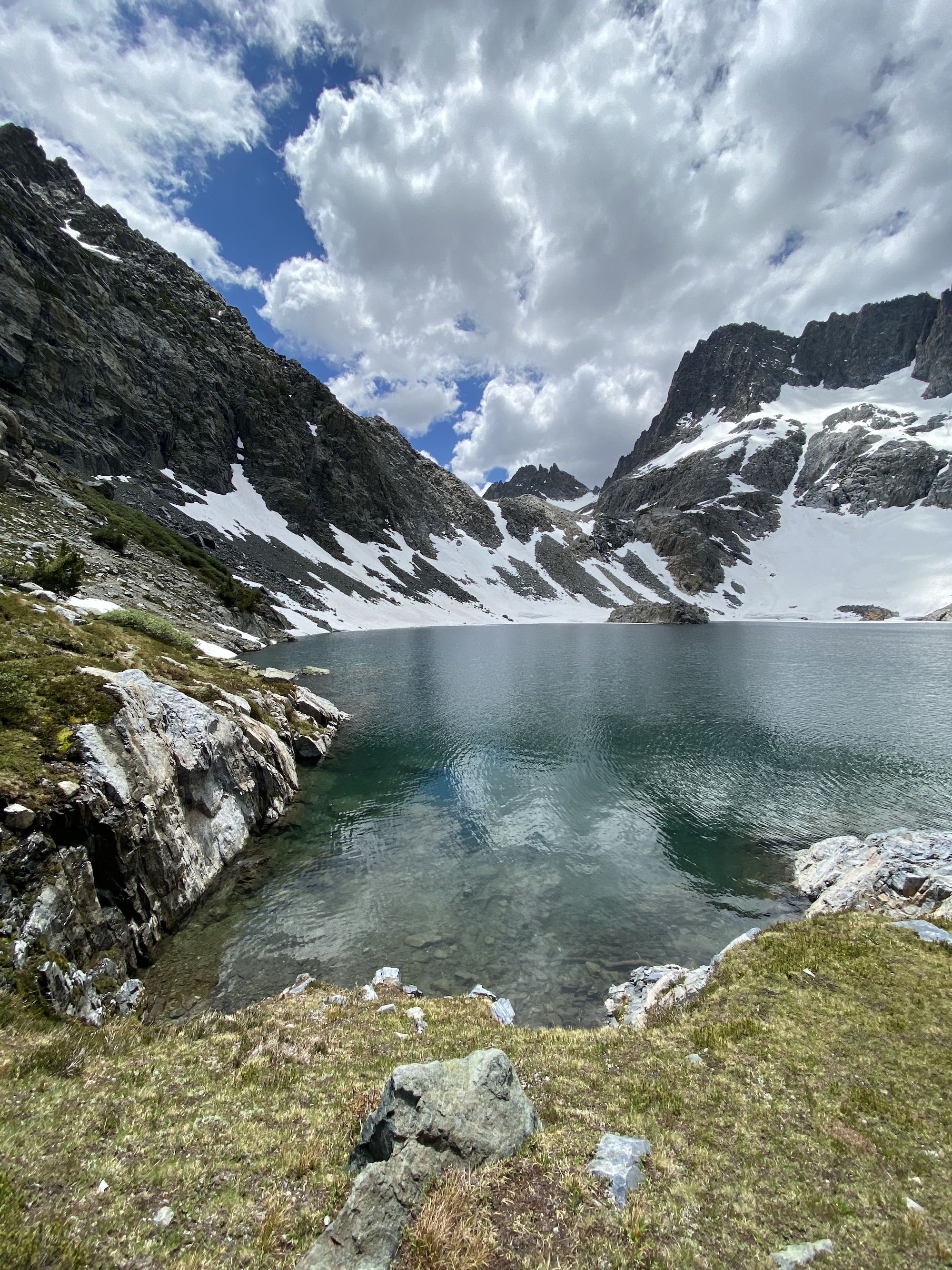
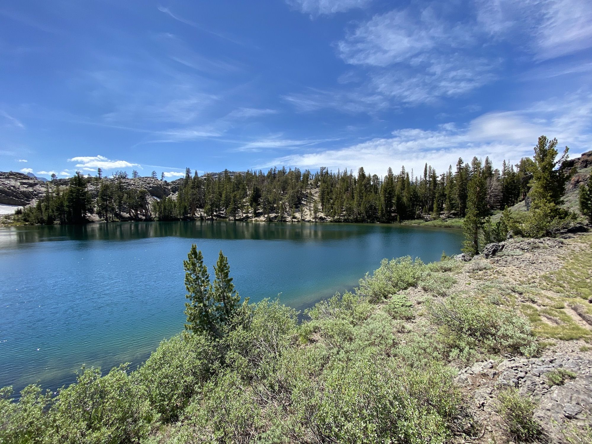
Finally, I could see Banner Peak and Thousand Island Lake. Enveloped in ominous clouds, it looked completely different than it had on that sunny late-July day I had first seen it the year before. It was stunning.
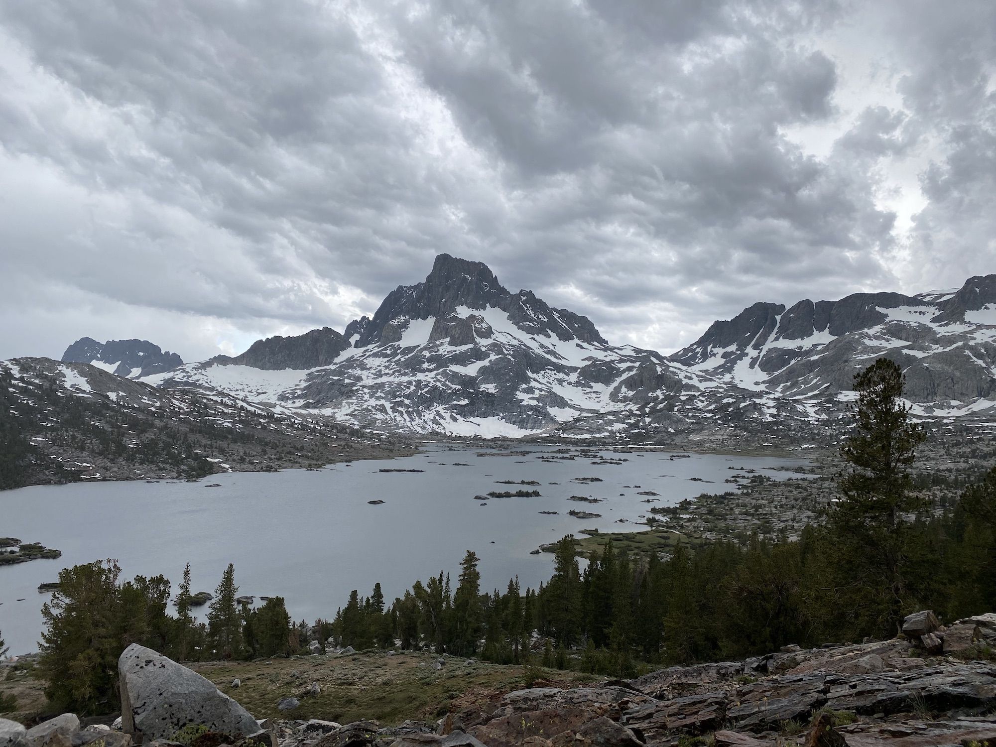
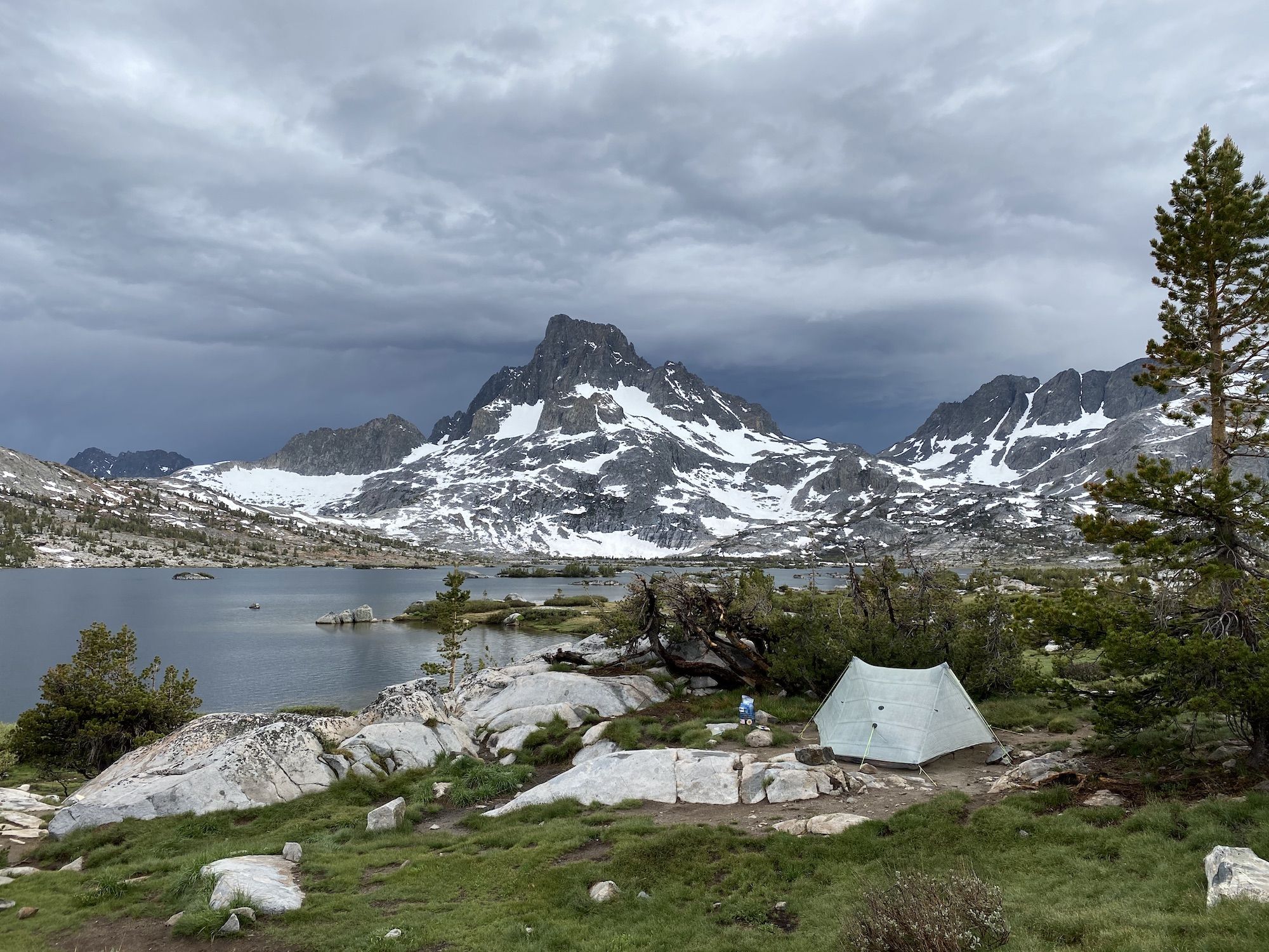
I arrived at the lake. I wanted to find a sheltered place for my tent so I could get inside and warm up. The scorching heat of the initial climb a few hours earlier felt distant as I walked along the shore in less than 10 °C (50 °F) with drenched clothes.
There were tens of other campers at the lake. Nonetheless, I found a spot for my tent, shielded from the wind by trees, and high enough from the lake to stay dry.
After changing into dry clothes, I laid in my tent under my quilt and dozed off for a while. I woke up to nearby voiced. My campsite was so tucked away that the group that came after me hadn’t seen me and had set up their two 8-person tents right underneath my camp, less than 20 yards away.
The rain had stopped, and I cooked up some pasta for dinner. After dinner, I had a mug of hot chocolate and cookies for dessert.
Tired after a long day, and with my belly full, I went to bed.
Day 2: Off the beaten path
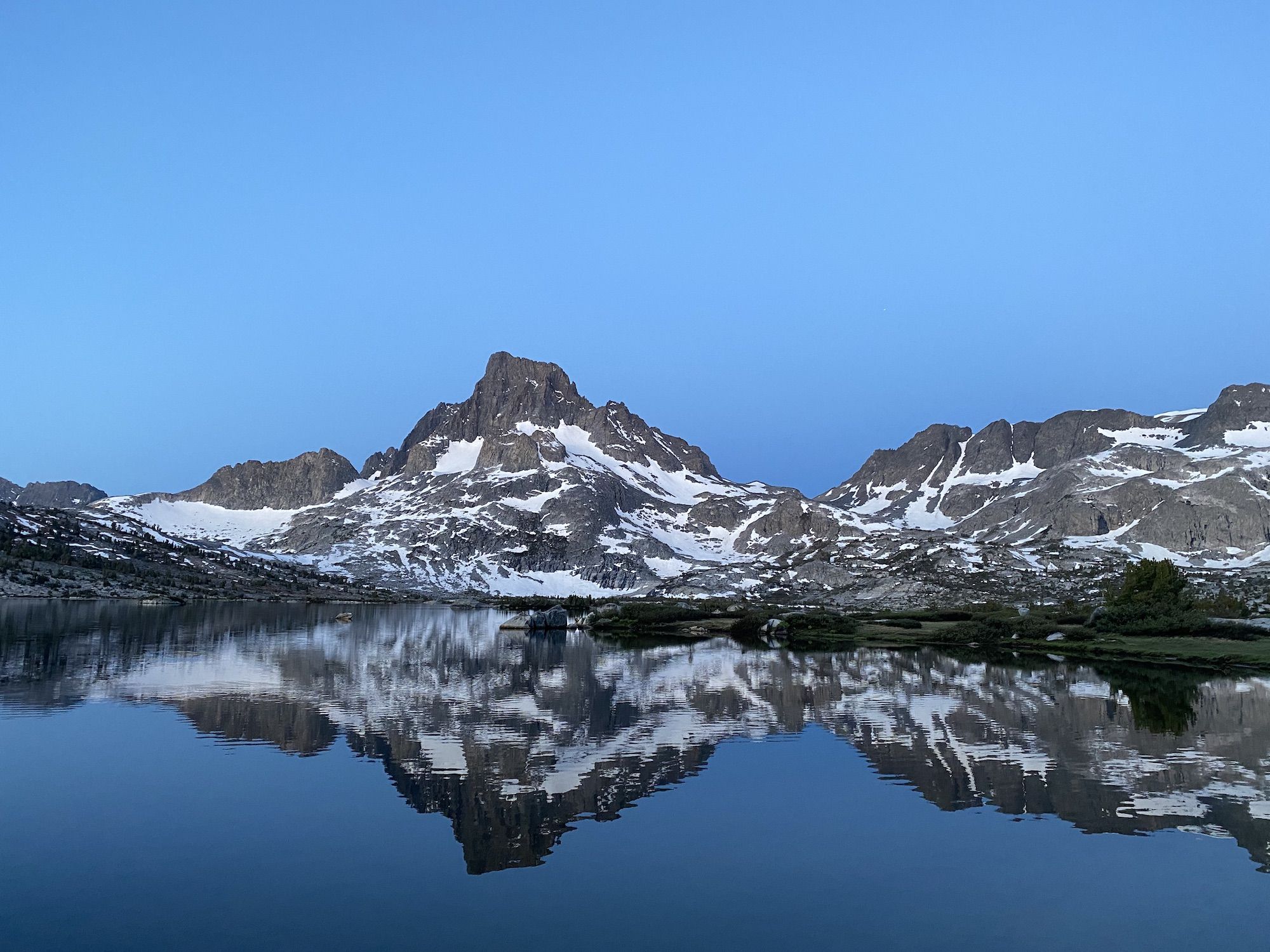
I woke up to rain pattering on my tent a few times during the night. When I went to pee at 3am, I could already see stars through the breaking clouds. At 5:30, when I got up to the sunrise, there wasn’t a cloud in sight.
After breakfast and packing up camp, I stopped to fish at Thousand Island Lake’s outlet. I had good success there the year before. I caught seven rainbows in less than 30 minutes, three of them over 15 inches. The rainbows up at 10,000 ft are slender, unlike the football-shaped porkers you might find stocked at lower elevations. But they put up a good fight.
After fishing, I continued toward Garnet Lake. Amazingly, there was less snow on the trail than there had been in late July the year before. There was no snow at all on the path—only a few patches here and there in shady spots.
I filled up on water from a small stream after Garnet Lake and continued on. After climbing up a few hundred feet from the lake, the JMT descends over 1,000 ft before Shadow Creek.
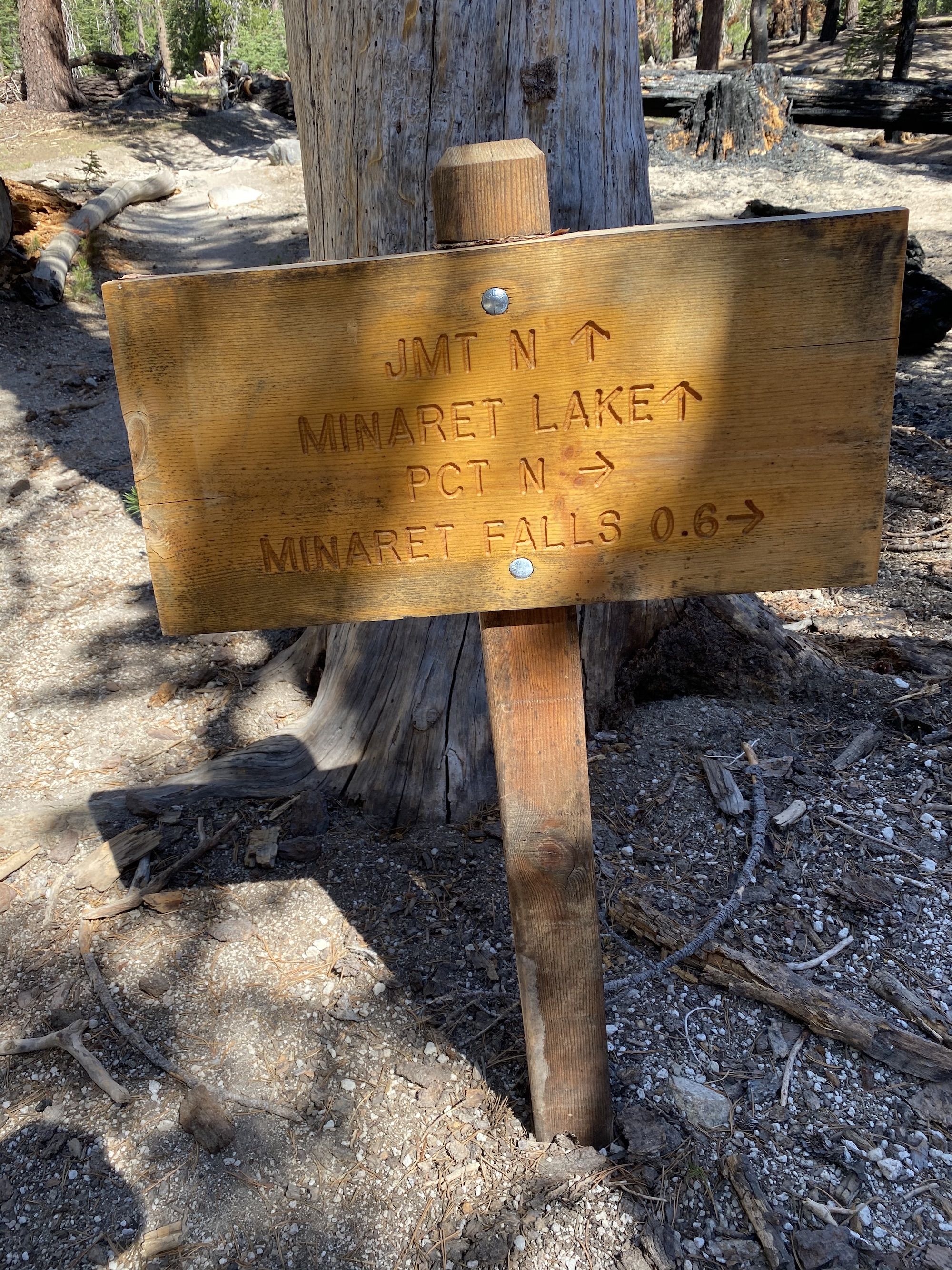
The JMT continued to the left, downstream along the creek. I turned right, towards Ediza Lake. I was excited to explore a new trail and leave behind the crowds of the JMT.
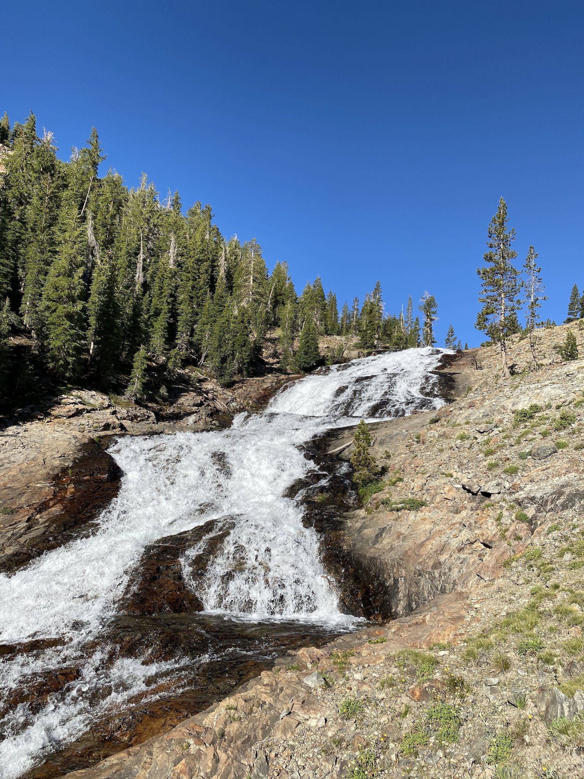
At times, the creek meandered through lush spring meadows. At times, it roared over granite cliffs.
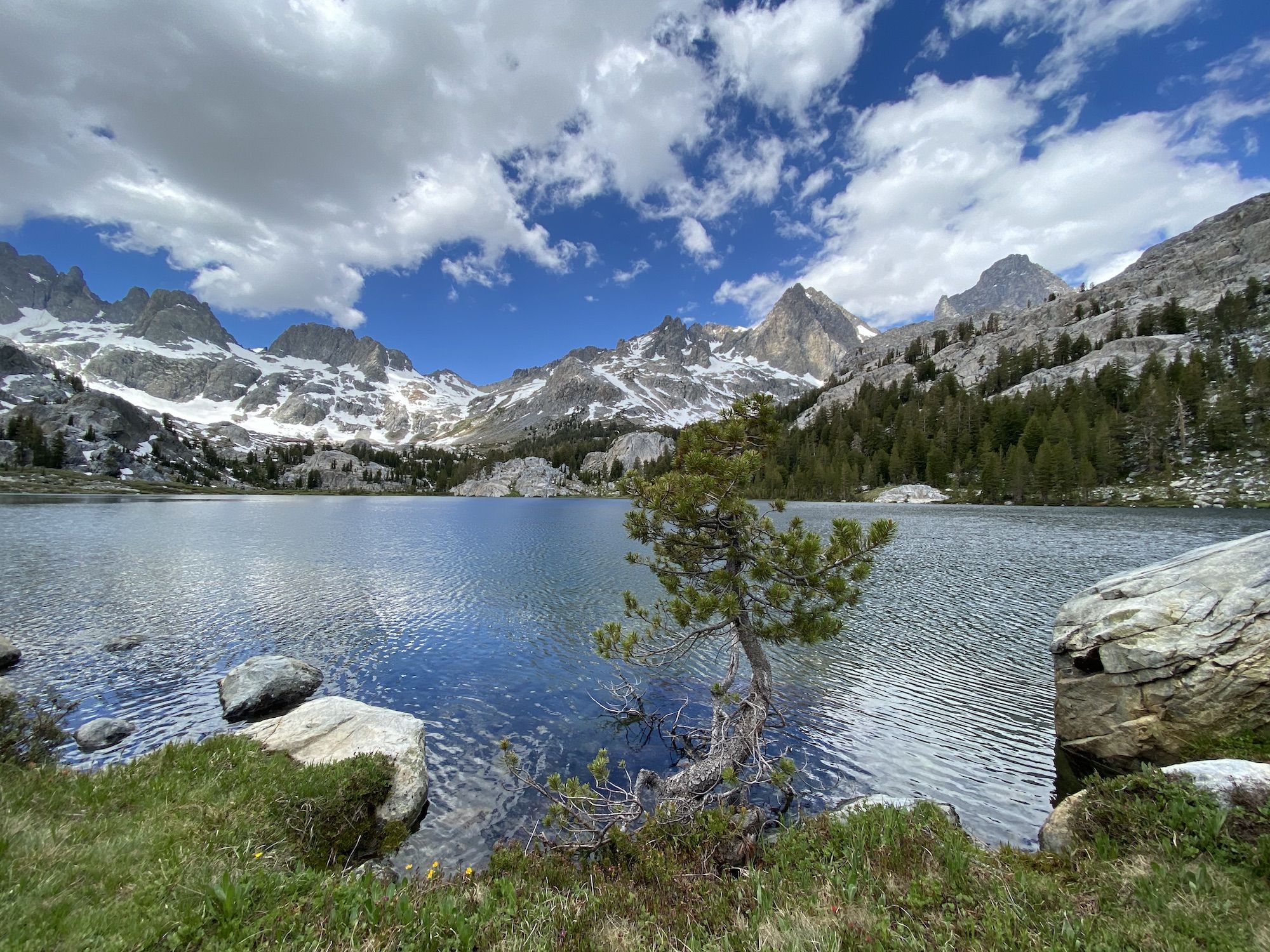
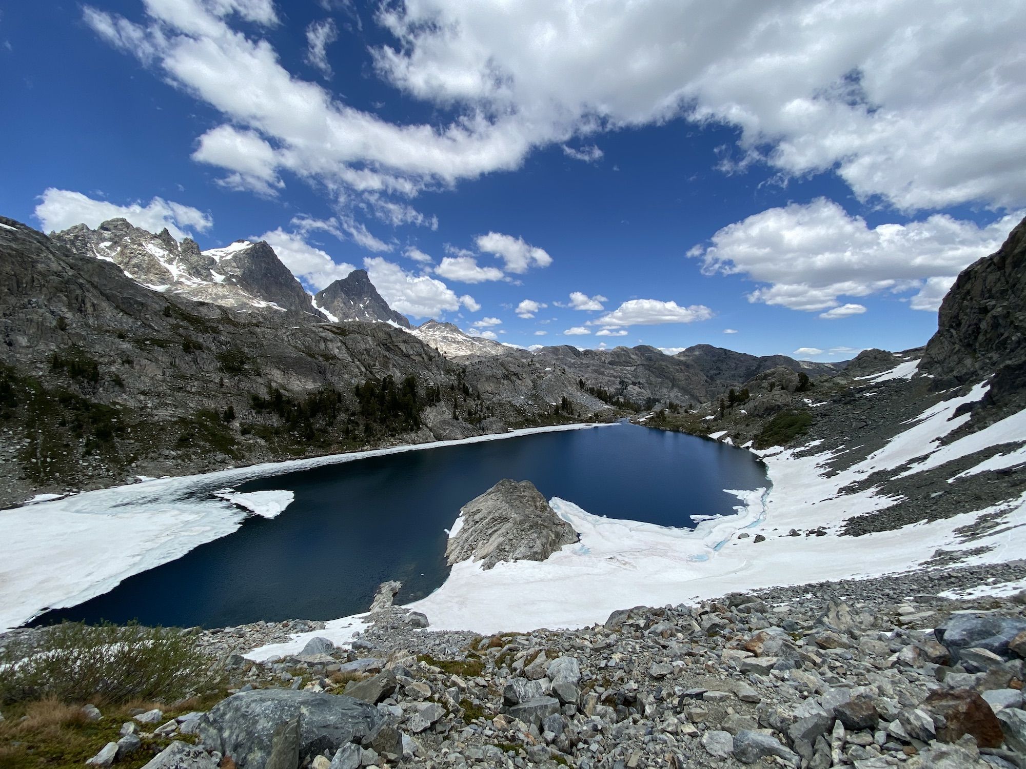
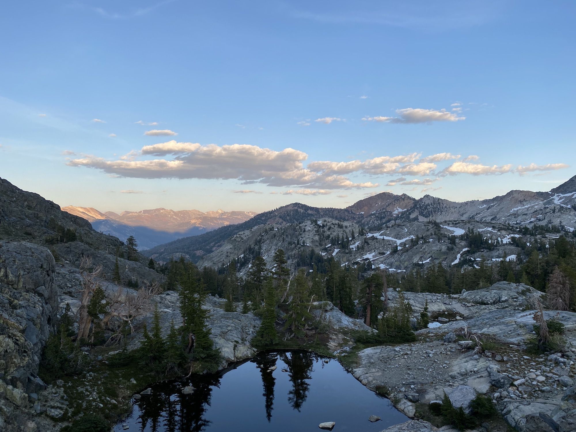
I arrived at Ediza Lake around lunchtime. I fished a while to see if I would have caught anything for lunch, but only got a tiny brook trout. Instead, I had tortillas with tuna. The view was spectacular.
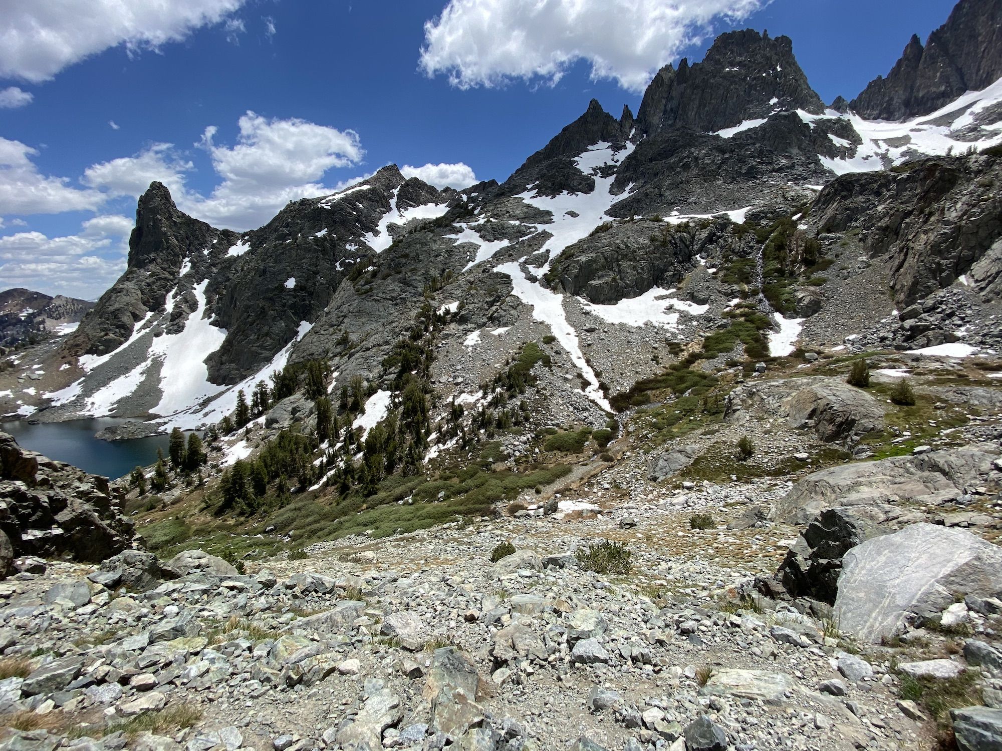
A small trail leads up from Ediza Lake to Iceberg Lake. True to its name, ice was still floating on the lake.
This was the end of the trail. From here, I continued off-trail around the lake and up to Cecile Lake. I traversed a steep talus field with lingering patches of snow.
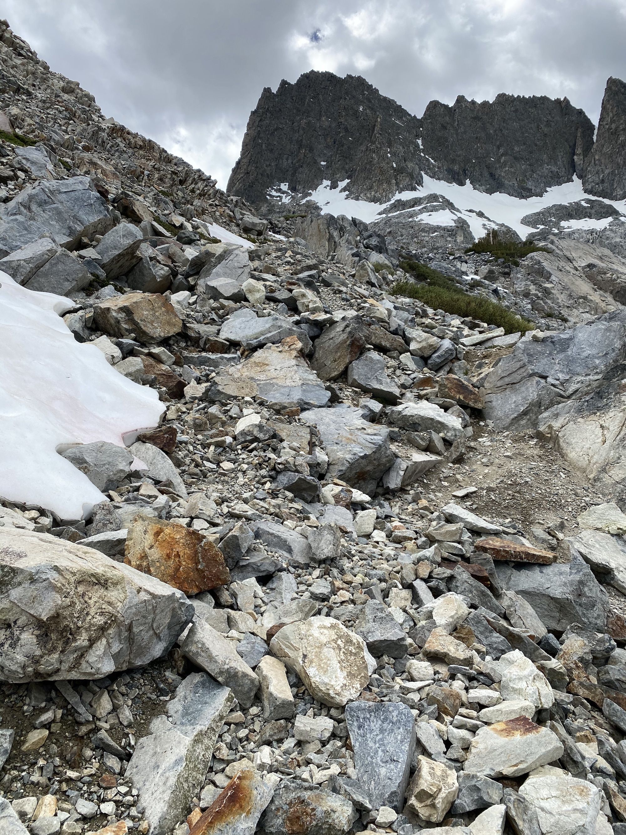
The snow was soft enough to kick solid footholds, but not soft enough for me to posthole. I was glad because slipping on the snow would have meant a long slide right into the frigid water.
The last push up to Lake Cecile was straight up a 45-degree snowfield. My legs were tired, and my lungs were struggling to catch a breath. I definitely wasn’t acclimatized to the altitude yet.
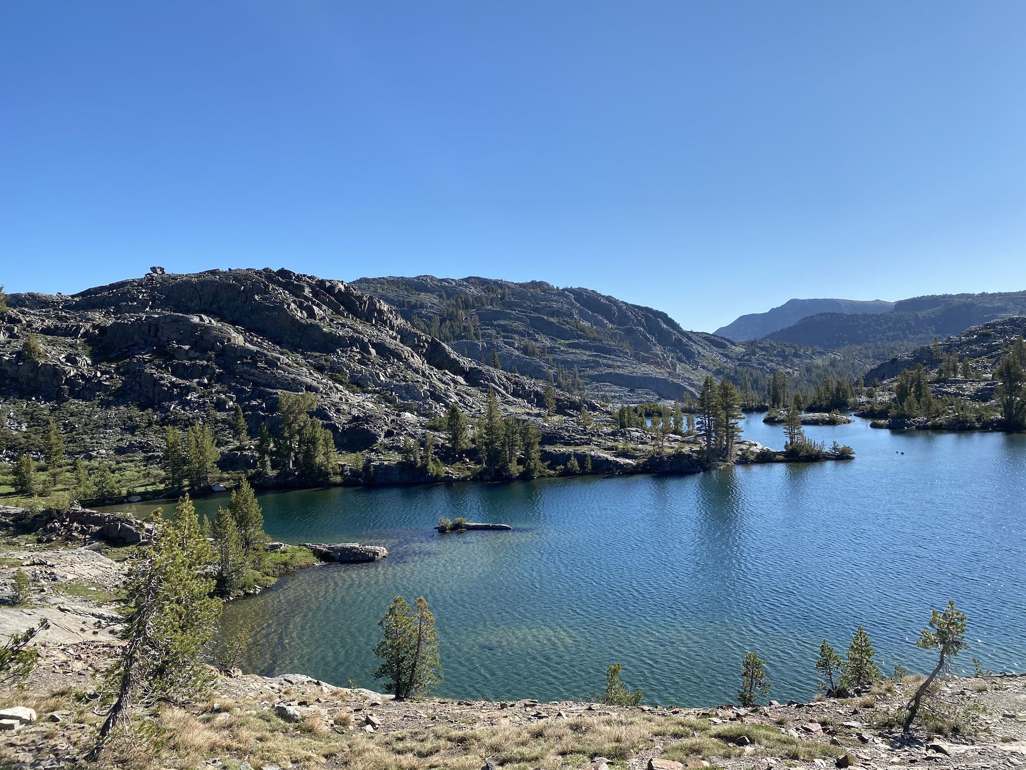
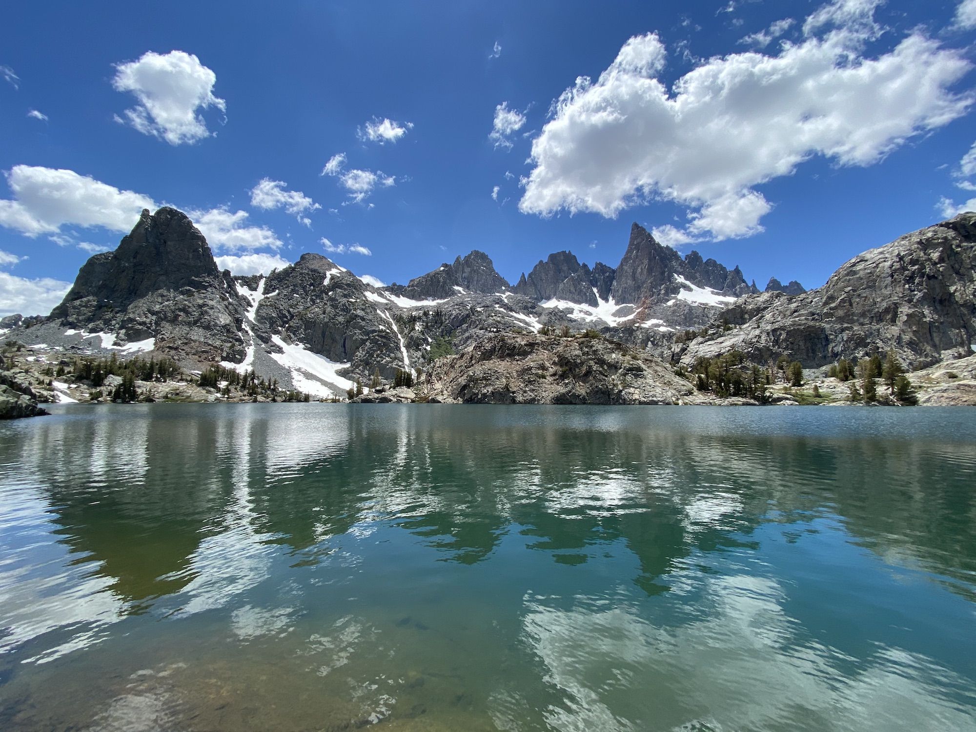
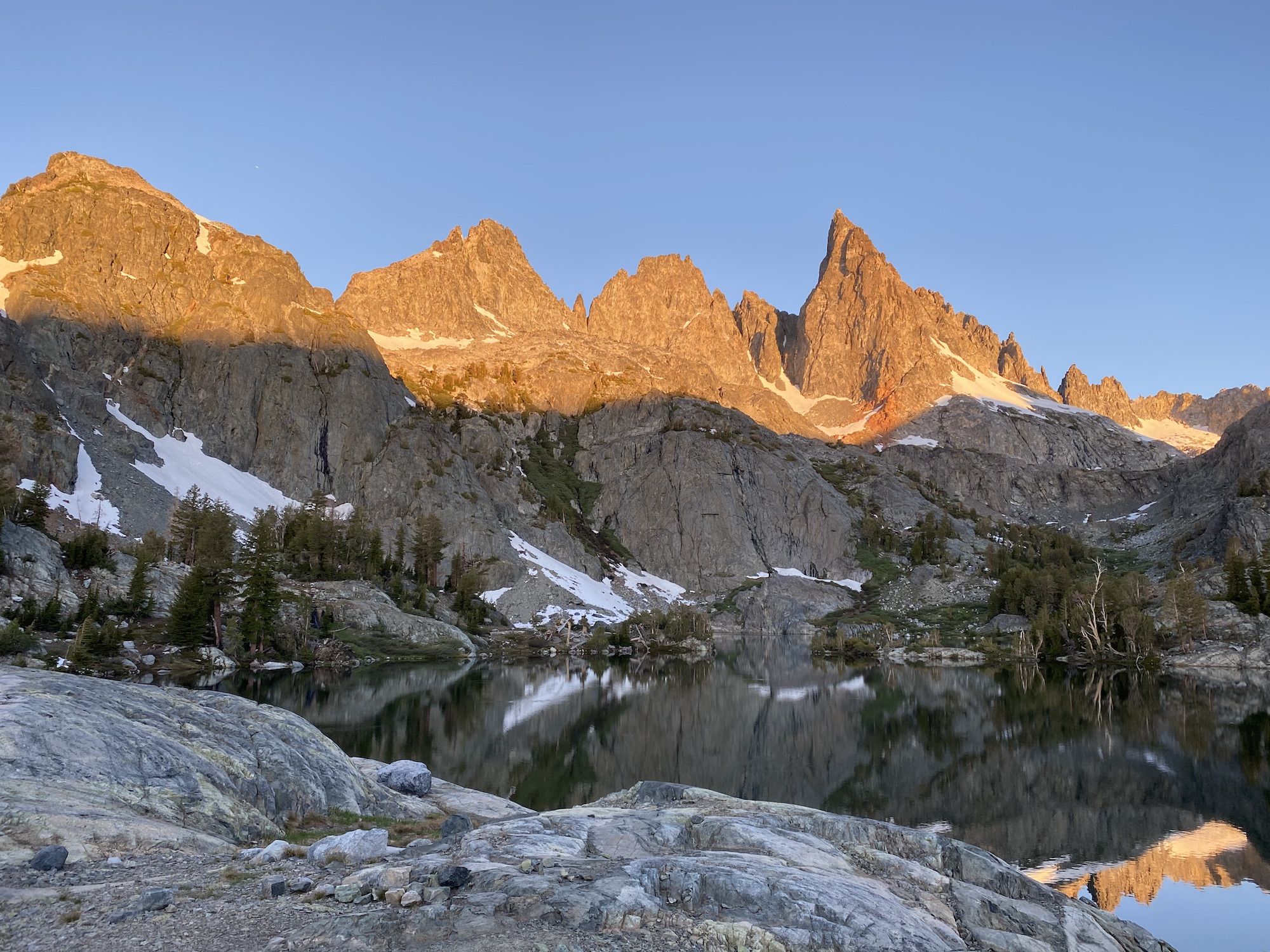
Cecile Lake was a deep blue color, surrounded by jagged rocks on all sides. To my great surprise, there were tons of brook trout in the lake, chomping down on anything and everything they could fit in their mouths.
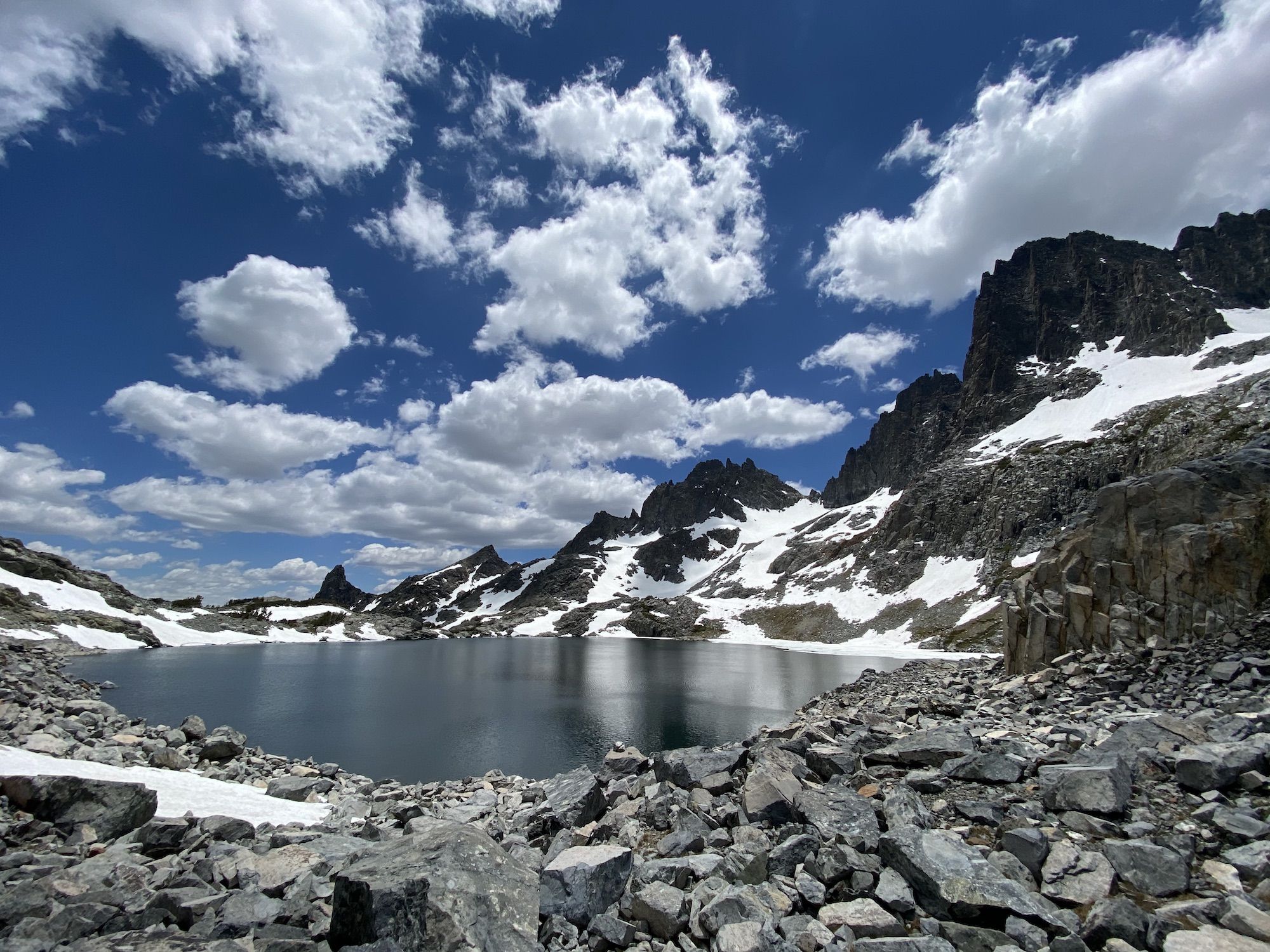
I continued on the rocks along the eastern shore of the lake and over a couple of small snow patches before reaching the pass leading down to Minaret Lake.
The small trail down to Minaret Lake was steep. The loose gravel and fist-sized rocks would often slide a bit from under my feet. After dropping several hundred feet in a quarter-mile, I reached the shore of Minaret Lake.
The shoreline was mostly rocky or marshy. The spot marked as a camping area on my Gaia map wasn’t inspiring, so I continued to the far end of the lake, past the outlet.
I found a somewhat shielded spot for my tent, set up camp, and went fishing.
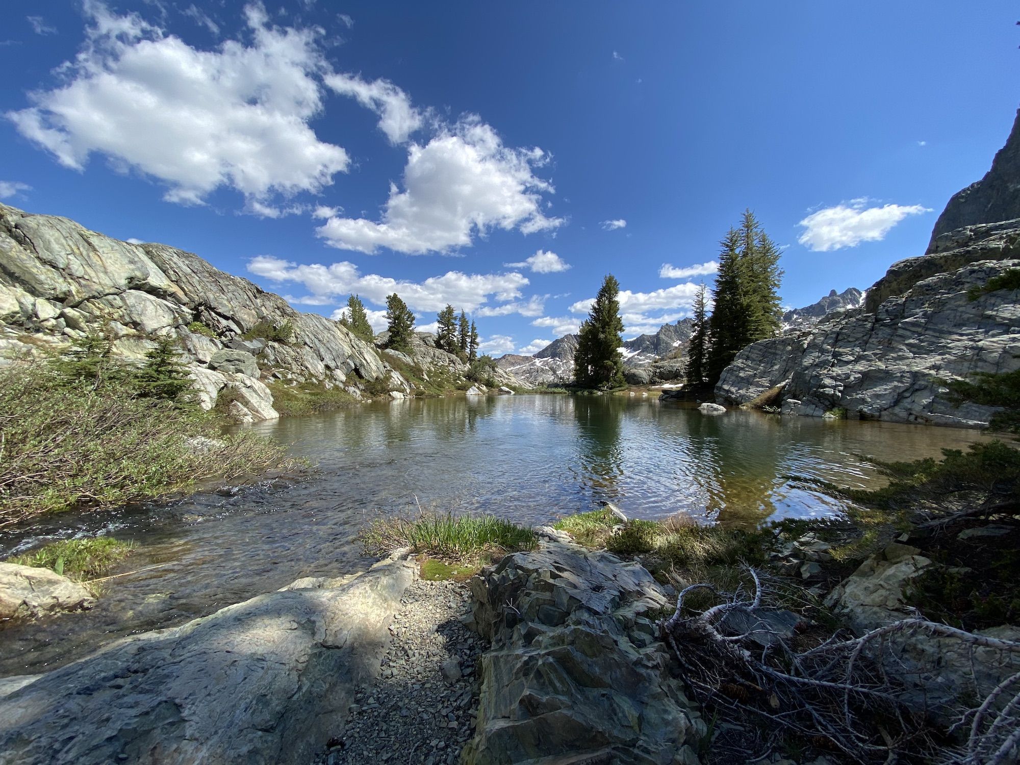
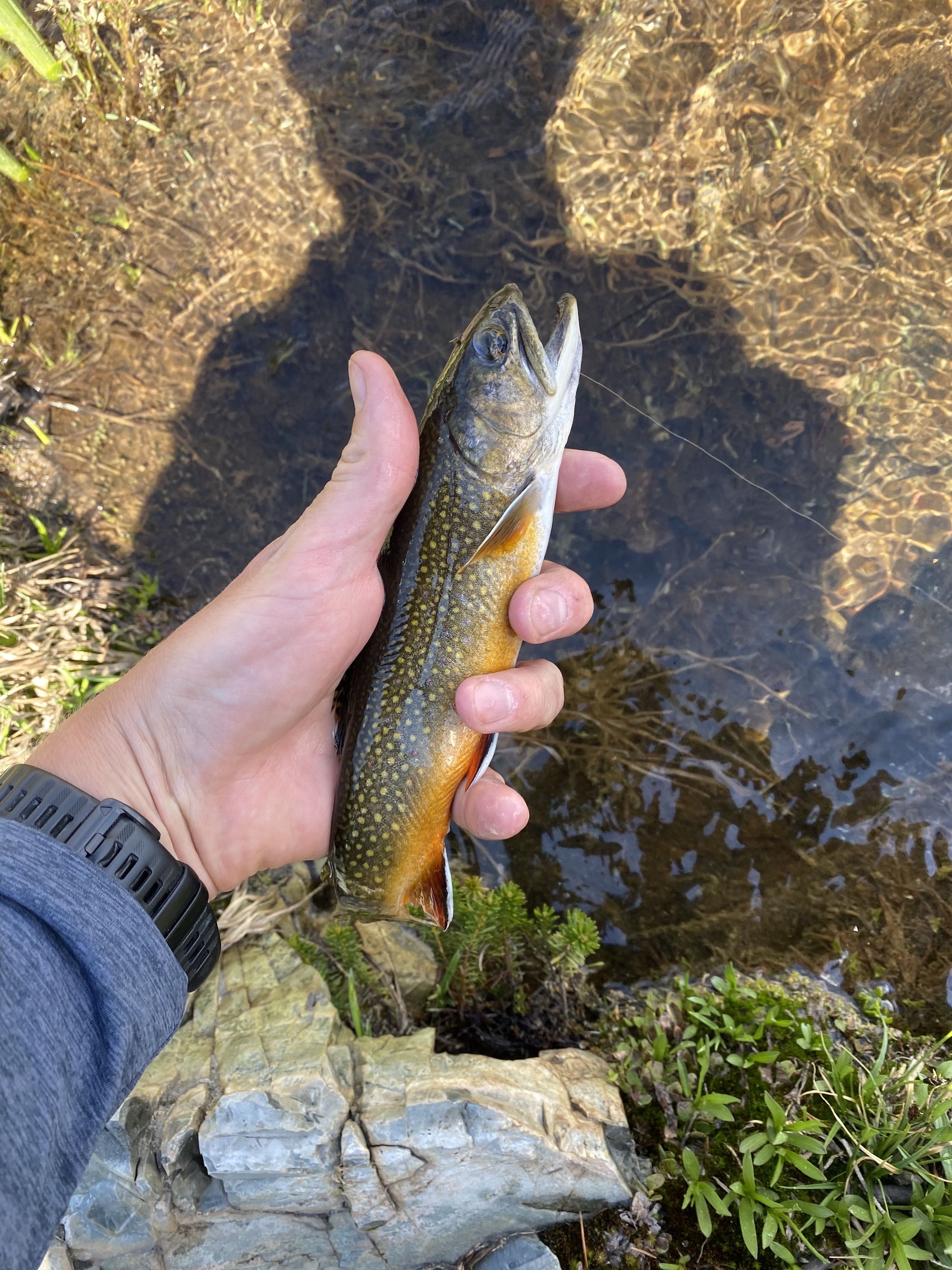
The outlet of Minaret Lake runs into a smaller lake before becoming Minaret Creek. The stream had carved a deep pool right where it dumped into the small lake, and it was full of brook trout.
On my first cast, I caught two brook trout. I continued catching fish on almost every cast and finally had to stop fishing after a while because I kept getting so much fish. I had hoped to pass some time fishing, but continuously having to unhook fish became a chore. Can’t remember the last time I’ve had that problem while fishing.
I was hungry after all the climbing, so I had an early dinner. I lied in the shade listening to an audiobook relishing not being on my feet.
I made some hot chocolate and ate cookies as the sun started painting the horizon in shades of orange and purple.
Day 3: The long haul
The sky was magical when I woke up in the middle of the night. The milky way was clearly visible. The only thing blocking the stars were the mountains. A hiker I met on the JMT the year before had coined the term star drunk to describe this groggy midnight amazement that stretches a 2-minute pee break to 10 minutes. Finally, the chill forced me to retreat back into the warmth of my quilt.
I awoke as the sun began to color the minarets a pale shade of pink. I ate breakfast on the rocky shore overlooking the lake—the mosquitoes that had been thick the evening before were thankfully still sleeping.
This would be a long day. I planned to join up with the PCT and take it north to Clark Lakes, over 20 miles.
The first several miles of the day was a steady downhill. I dropped more than 2,000 ft before the PCT junction. It was still early when I got there, so I decided to take a small detour to see Devil’s Postpile.
I hadn’t been to Devil’s Postpile in years. The last time I was there, we got there with my wife and her friend just before sunset and had the place almost entirely to ourselves. Now it was packed with people.
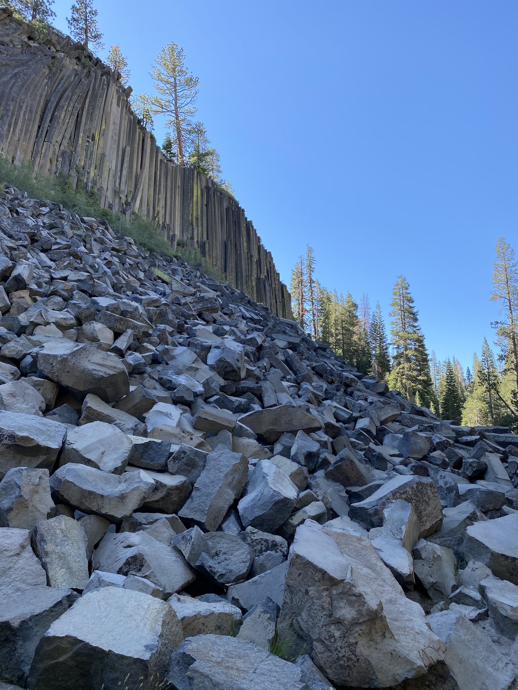
Not wanting to spend time in a crowded place, or interested in catching the ‘rona, I took some pictures and headed back to the trail. Two days of trail stink ensured that non-hikers socially distanced themselves from me without asking.
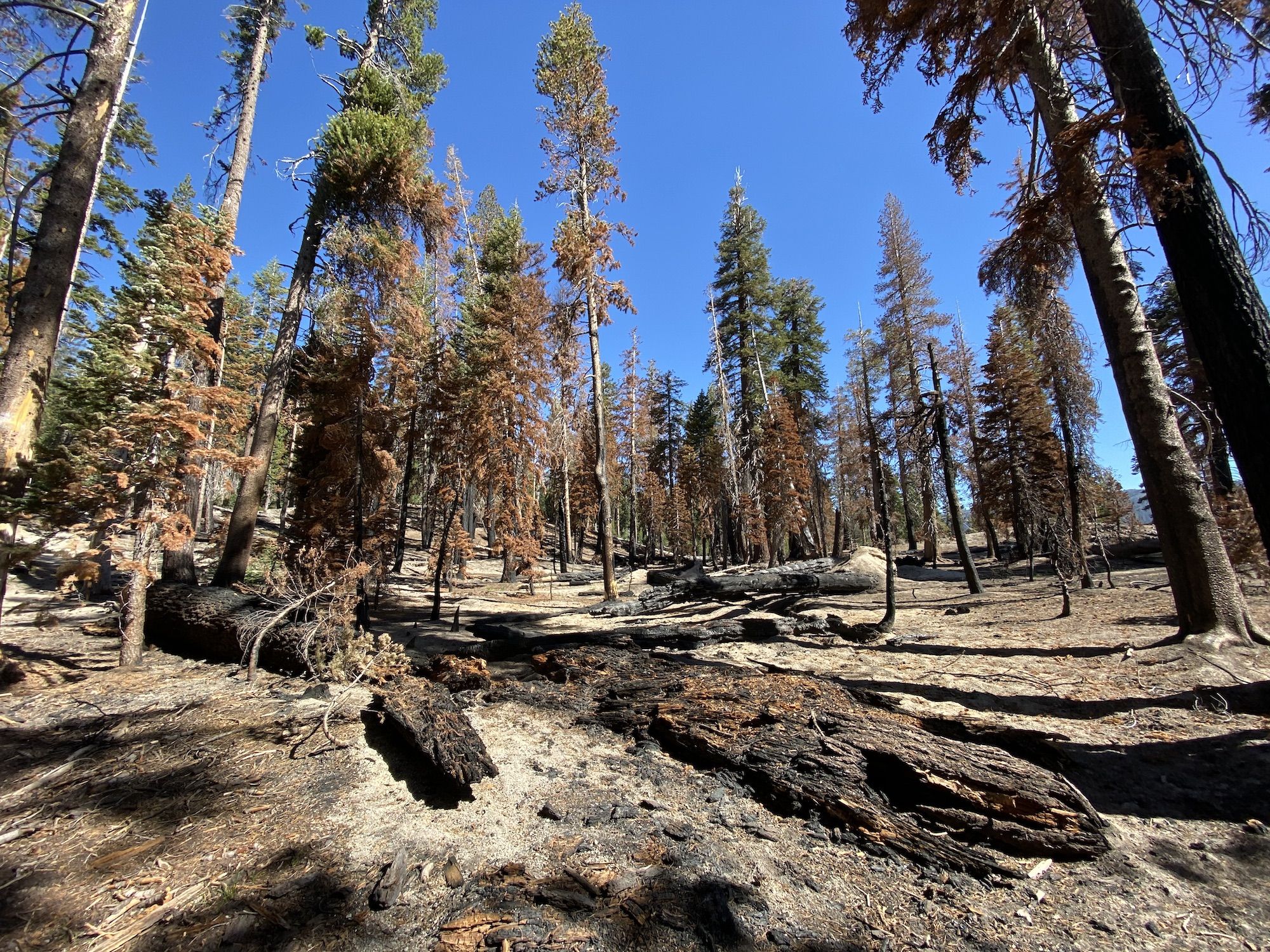
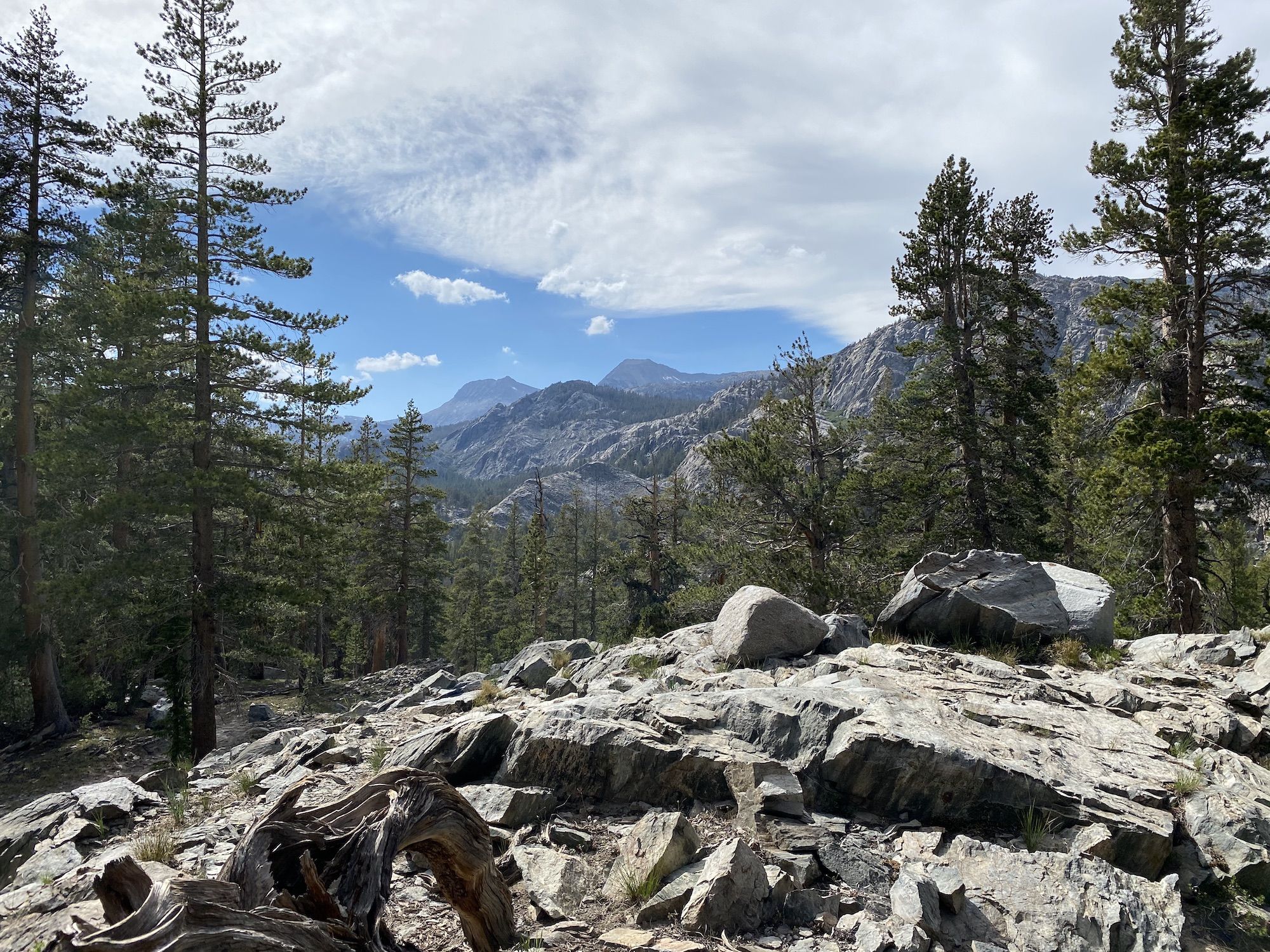
From the Devil’s Postpile junction, the PCT passes through a beautiful but unremarkable forest. Right at the intersection, there had been a recent fire and a bit later a vast blowdown. There were occasional views of the San Joaquin River.
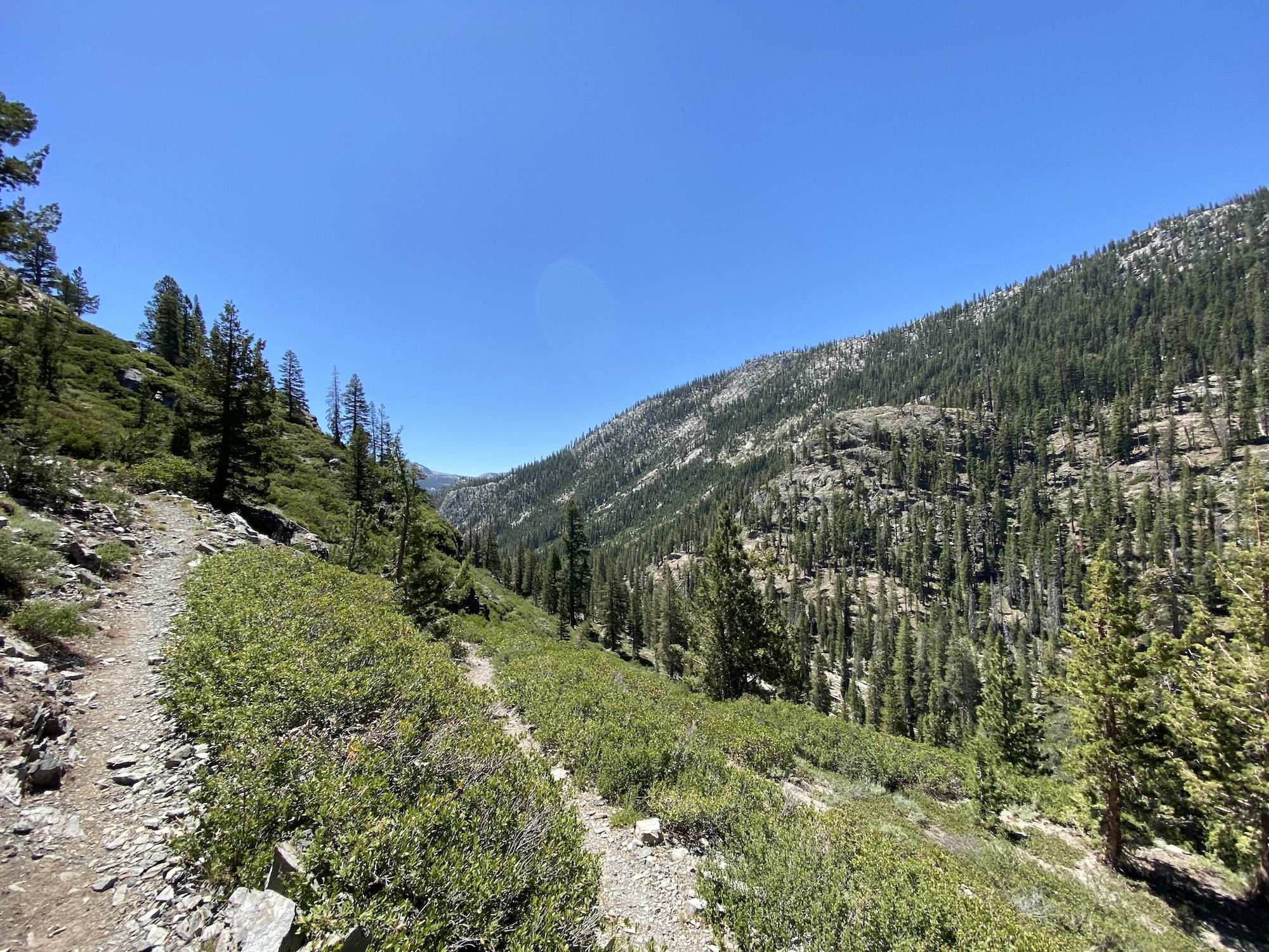
The trail kept climbing steadily towards Agnew Meadows. Just before getting to Agnew, the views started opening up. The campground was closed due to Corona restrictions. I kept on walking, planning to have lunch when I got up higher.
The trees gave way to chaparral as I got higher in elevation. Every once in a while, the trail passed small streams thick with willows. I found a shaded log overlooking the mountains to the west and dropped my pack.
I let my shoes and socks dry out while I ate lunch. I’d already hiked almost 15 miles and only had about five more to go, so I took my time and rested my legs.
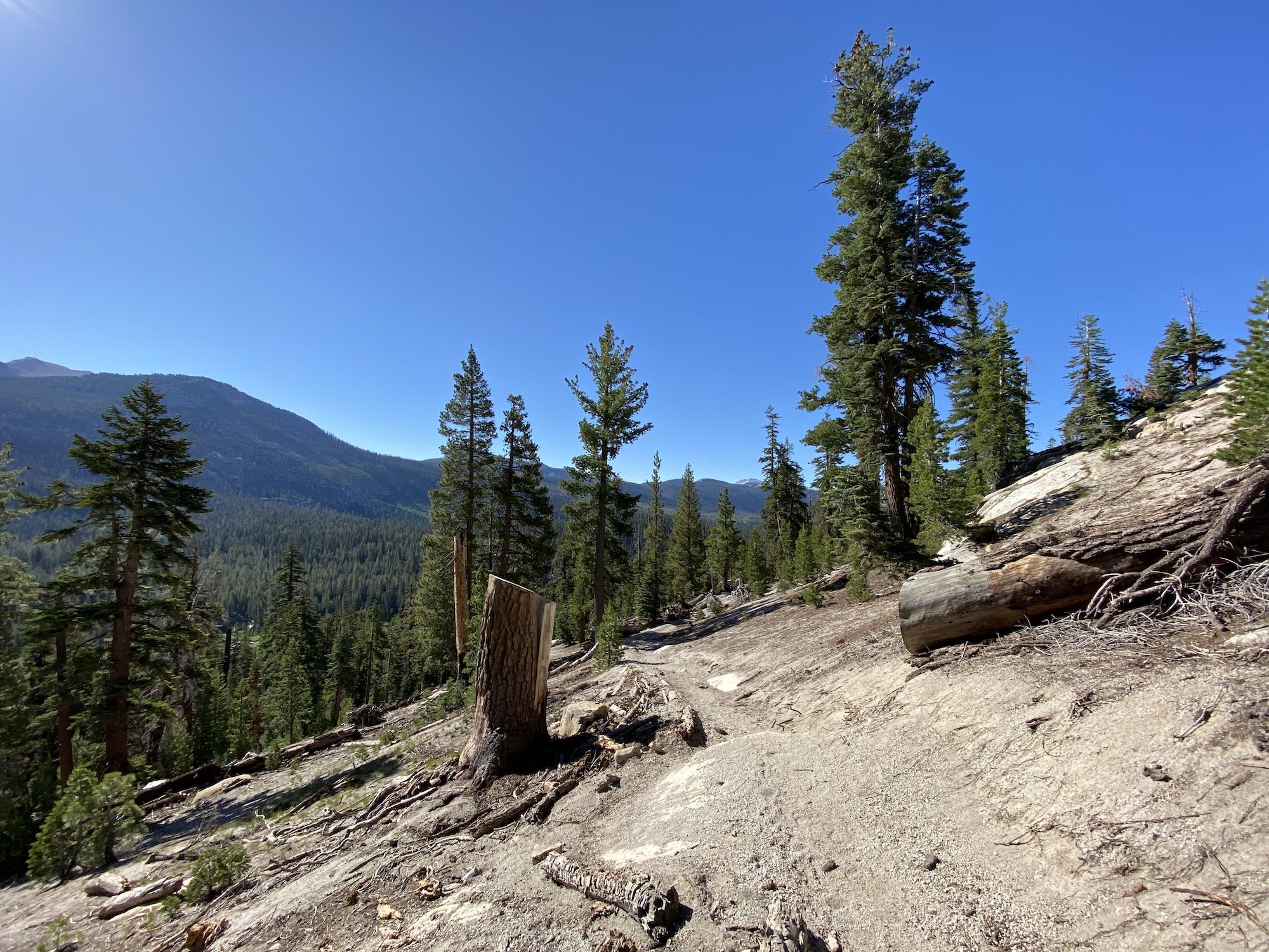
There was very little shade on the long stretch along the rim. A few miles down the path, the trail split up: the PCT continuing left towards Thousand Island Lake and a smaller trail towards Agnew Pass, where I was heading.
As soon as I got off the hiking equivalent of an interstate highway, the trail became narrow and overgrown. I couldn’t see any new footsteps in the sand since the rain had erased earlier tracks.
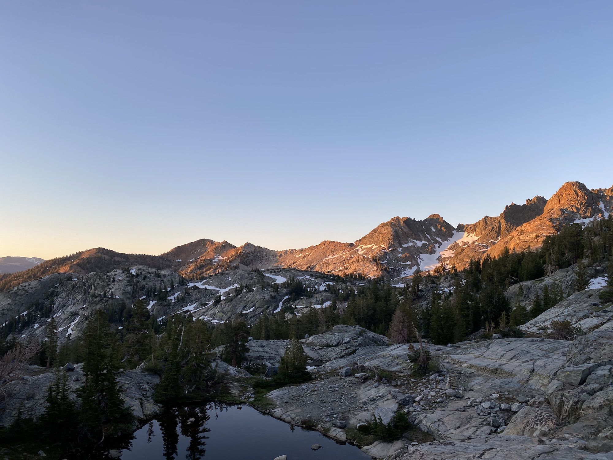
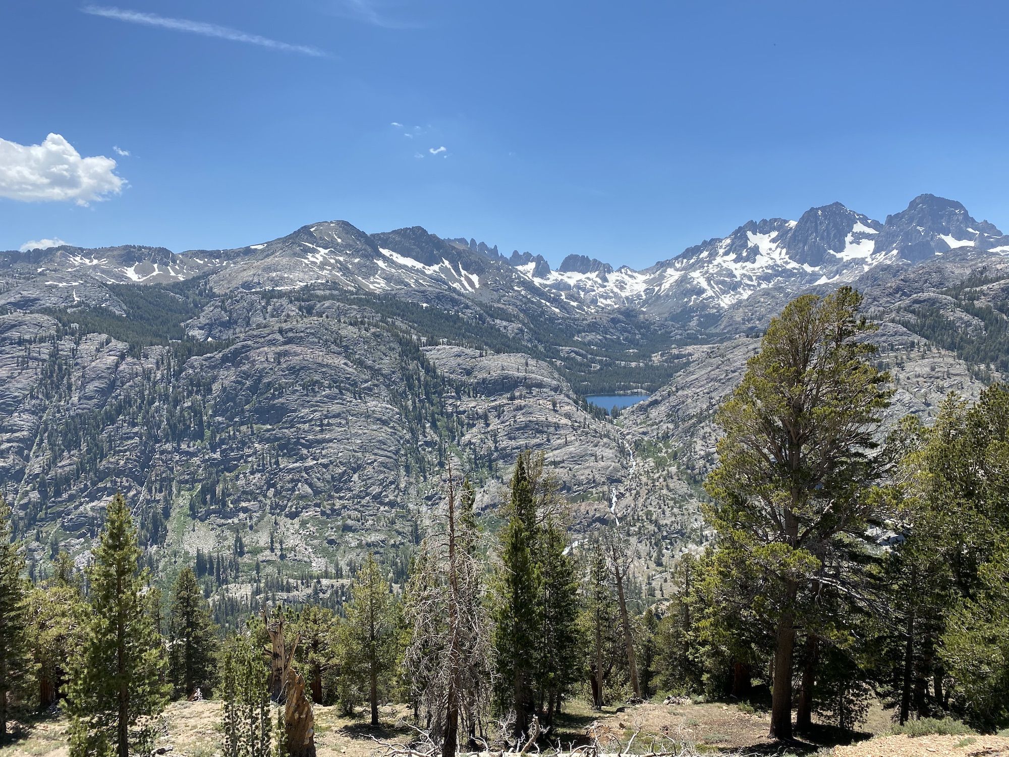
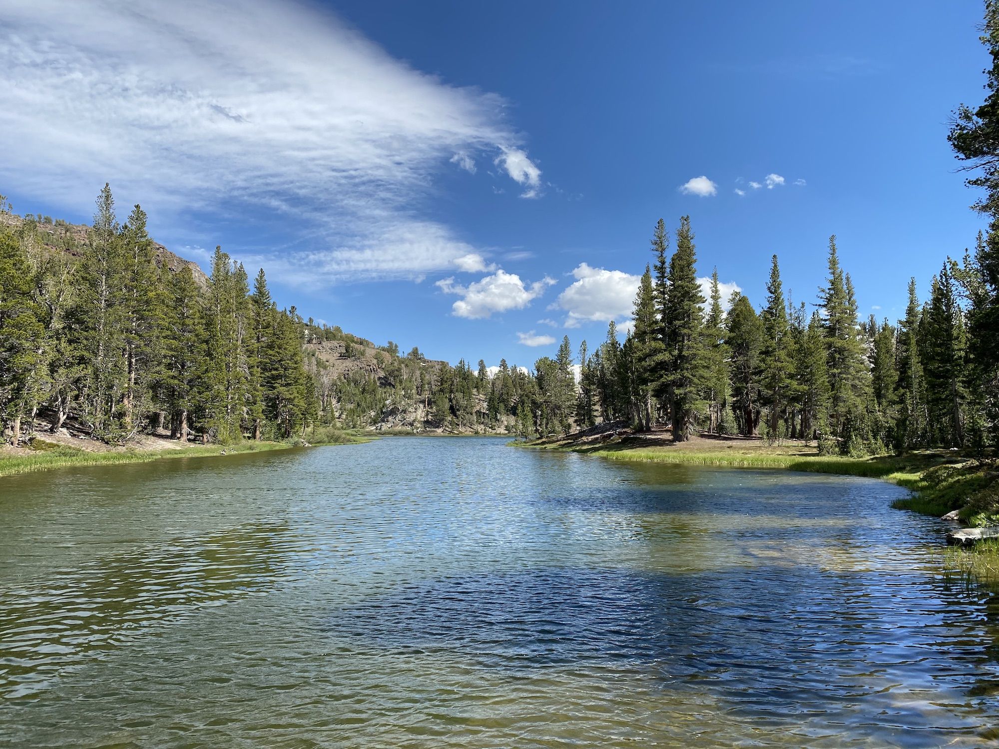
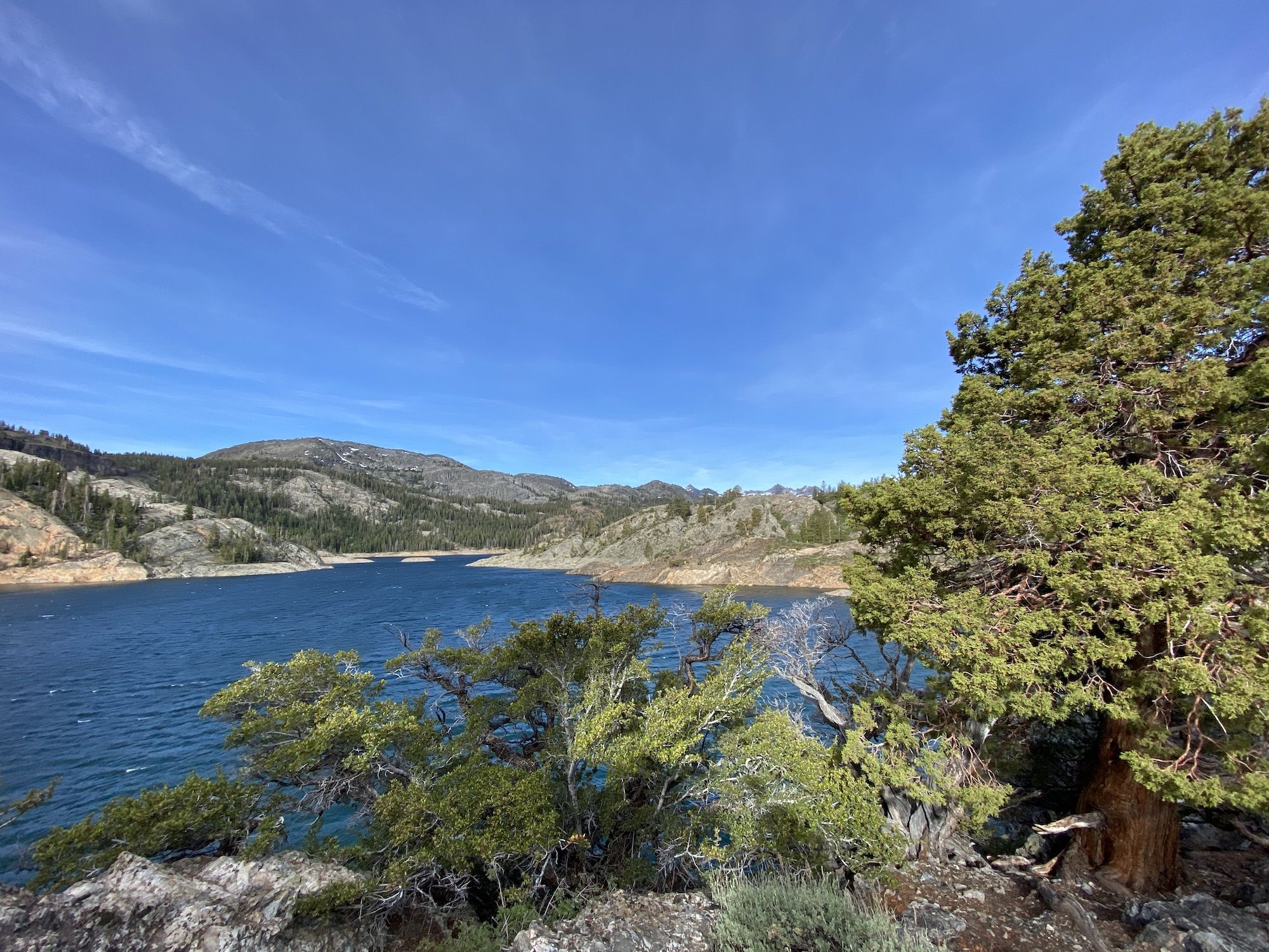
On top of the pass, I was greeted by Summit Lake, a deep blue lake with a steep shore. I only had half a mile left to my campsite at Clark Lakes.
Clark Lake was not what I had hoped. It was a shallow, murky lake with reeds along most of its shore. There were already a few other groups of campers along the lake. I decided to have a snack break and continue back down to Gem Lake for the night.
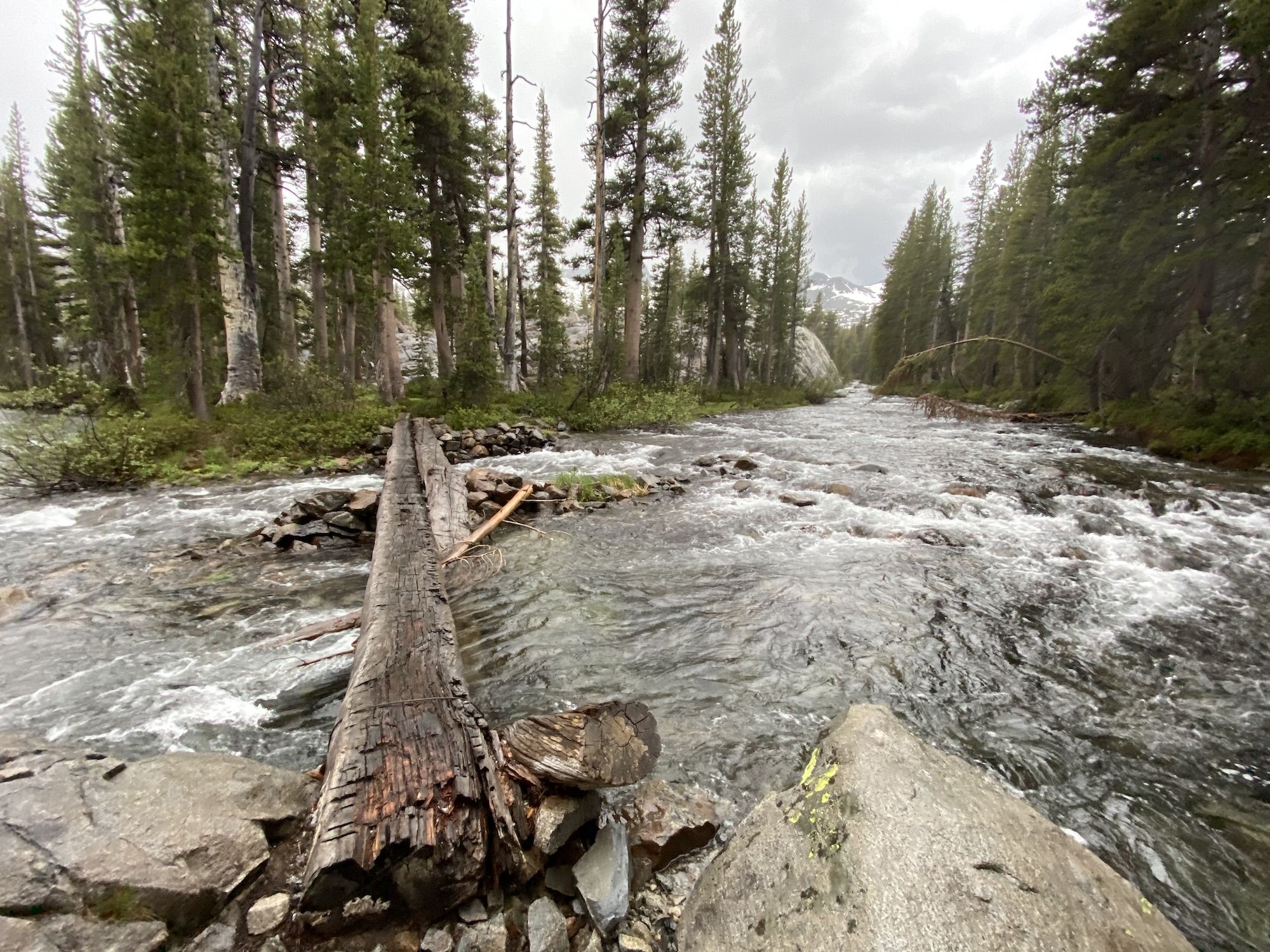
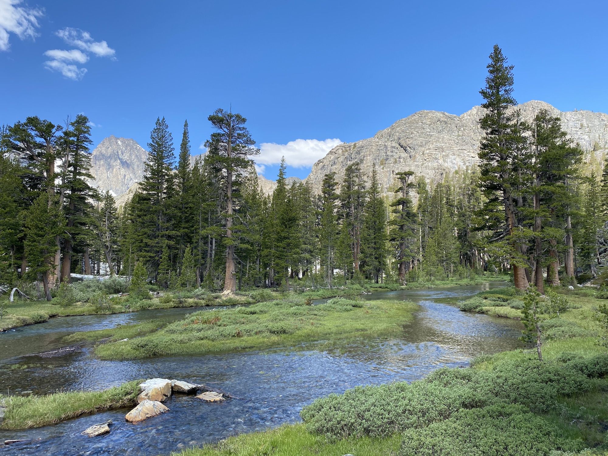
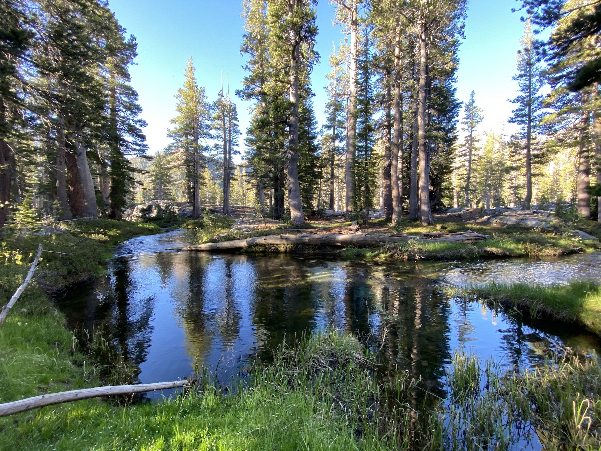
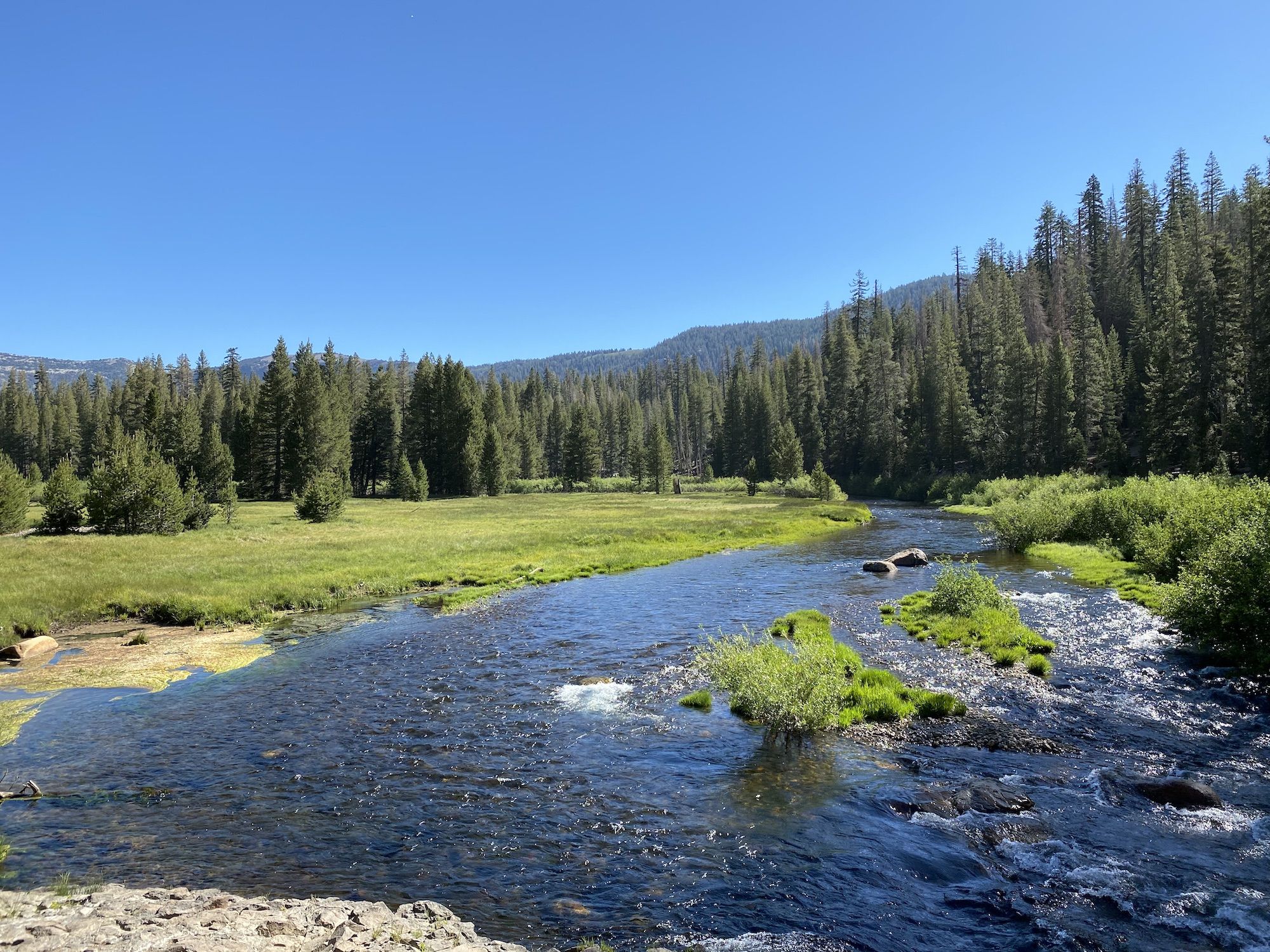
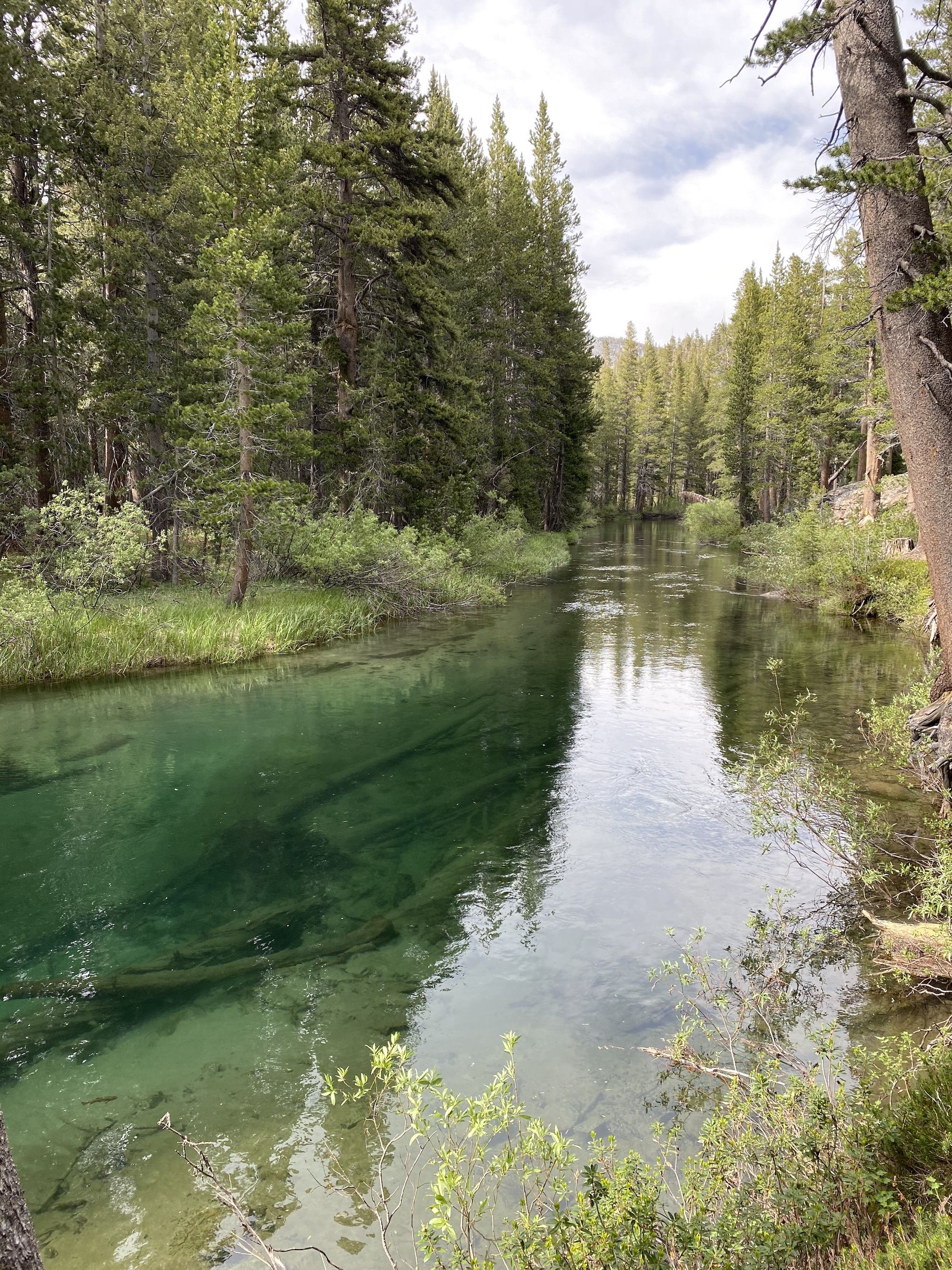
Gem Lake was 800 feet below Clark. The trail wound down through the sometimes thick forest without views. I passed a couple of shallow lakes before coming to Rush Creek.
Rush Creek flowed calmly through the forest where the trail crossed it. There was a beautiful campsite right before the bridge, although it was a bit dark and overrun by mosquitoes.
I labored over a last small hill before seeing Gem Lake. The lakeshore is steep and rocky. There weren’t many campsites that looked promising. Most were either exposed or rocky.
I finally settled on a spot right before the creek I had stopped at for lunch on the first day. I set up camp and laid down for a while to let my legs rest.
I had an early dinner and spent most of the night relaxing in the tent, listening to my audiobook. I tried fishing, but my Tenkara rod wasn’t really meant for big lakes like this.
As the sun faded away, the wind picked up.
Day 4: Back to civilization
I had barely shut my eyes when I woke up to the tent pushing up against my head. The wind came in strong gusts, 5-10 minutes apart. In between, it was almost wind still. Then, I could hear a faint whisper in the treetops. The whisper grew louder and louder until the blast hit the tent like a runaway truck.
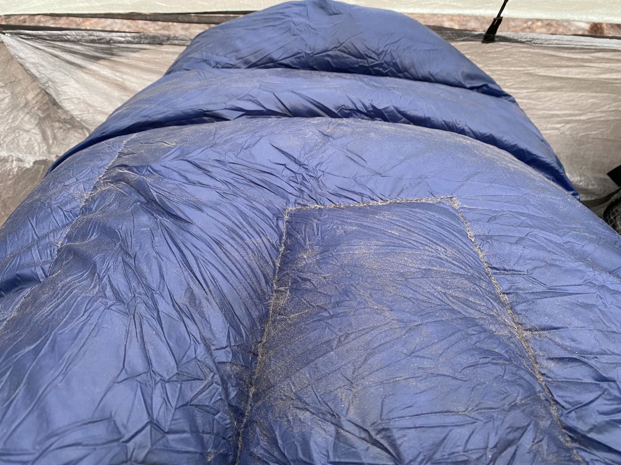
The tent was holding up well. The more significant issue was that the wind blew in a fine dust that covered my gear and got in my eyes and teeth.
Tired from a sleepless night, I got up after 7. I had a quick breakfast and packed up camp.
The wind was still ripping. It pushed me with a surprising force when I went over the small pass down to Agnew lake. My sleeping pad acted like a sail on my back.
Aside from the wind, the walk down to the trailhead was easy going. I covered the 5 miles in just under two hours.
As I drove away, I could see the wind ripping up sheets of water from June lake, spraying the hillside hundreds of feet away.